
Guides · Hong Kong
10 Best Hikes in Hong Kong

CEO and co-founder
This guide covers the 10 best hikes in Hong Kong, ordered so you can build a sensible week of walking rather than tick off a random list of peaks. Roughly 40 percent of the territory's land area sits inside 24 Hong Kong country parks, and the trail network running through them is why a city of 7.5 million people can put you on an empty ridge 40 minutes after you step off an MTR platform.
Every entry below gives the trail distance in kilometres, the total elevation gain in metres, a realistic round-trip time and an honest difficulty rating, plus the exact MTR station and exit, the bus or green minibus route number that reaches the trailhead, and a Pro Tip. The list runs geographically and by difficulty: Dragon's Back and the Victoria Peak Morning Trail on Hong Kong Island first, Devil's Peak and Lion Rock in Kowloon next, then the harder New Territories and Sai Kung climbs, with Lantau Peak last.
Hong Kong hiking trails are unusually well signed. The four long-distance routes - the Hong Kong Trail, the MacLehose Trail, the Wilson Trail and the Lantau Trail - carry numbered distance posts every 500 metres, and each post shows a code you can read to the 999 operator to give your exact position. The Agriculture, Fisheries and Conservation Department publishes the full network, section maps and safety notes on its Enjoy Hiking site. One Octopus card covers the MTR, franchised buses and green minibuses on every route in this guide; red minibuses are still cash only, so keep coins in your pack.
Two Hong Kong Observatory warning systems shut these trails down, and both escalate fast. The rainstorm warning runs amber for more than 30 mm of rain in an hour, red for more than 50 mm and black for more than 70 mm; at red or black, get off the ridge and out of every streambed, because these hillsides shed water in minutes and landslips follow. Typhoon signal No. 8 or above suspends most bus and ferry services and closes country park facilities. Treat both as instructions rather than advice - hikers have drowned in flash floods here.
Season matters more than fitness. From May to September humidity sits between 85 and 95 percent and highs reach 33C, which turns the staircase climbs on Lantau Peak, Pat Sin Leng and Lion Rock into heat-exhaustion risks rather than workouts. October to March is the real season, and those dry months bring the opposite hazard: hill fire danger warnings are frequent from November through April, when one discarded cigarette can close a country park. Carry your rubbish out and never light a stove outside a designated barbecue site. Walkers building a wider regional trip often put Taipei on the same itinerary, where the terrain is comparable and the season runs cooler for longer, which makes it a sensible second stop rather than a competing one. Fire closures and typhoon signals both land at short notice, so check Hong Kong weather in the days before a summit attempt rather than the week. Trailhead access is the other half of the problem, and the hotels in Hong Kong closest to an MTR station cut most approaches to under an hour. Hikers building a wider East Asian trip usually add Seoul at the other end of the calendar, where the granite ridges are steeper and the walking season runs from April into November rather than collapsing into the four dry winter months that work here. That inversion is the useful part: the two cities cover each other's dead seasons almost exactly, and a single long-haul fare reaches both. For a third stop with no closed season at all, Singapore keeps its reservoir trails open year round and sits four hours south in the air.
1Dragon's Back - The Ridge Walk That Defines Hiking in Hong Kong


The Dragon's Back trail is Section 8 of the Hong Kong Trail, and it earns its reputation inside the first ten minutes. From the To Tei Wan trailhead on Shek O Road the path climbs steadily onto the ridge, then runs along an undulating spine with Tai Tam Bay on one side, Shek O and Big Wave Bay on the other, and the South China Sea filling the horizon.
Shek O Peak, the high point, tops out at 284 m. Walking the ridge and dropping down to Big Wave Bay makes a 7.6 km point-to-point with roughly 490 m of cumulative ascent, taking 2.5 to 3 hours at a steady pace. Cutting out at Tai Tam Gap shortens it to 4.9 km and about 1.5 hours. Difficulty: easy to moderate, on a paved and stone-step path the whole way, with no scrambling.
The catch is popularity. A Sunday morning puts several hundred people on a ridge that is two metres wide in places, so the photographs everyone comes for take patience.
Pro Tip: Stay on bus 9 past To Tei Wan to Shek O village for breakfast, then walk back along Shek O Road and start the ridge around 8am. You will have it nearly to yourself, and you can finish with a swim at Big Wave Bay before catching bus 9 back to Shau Kei Wan.
2Victoria Peak via the Morning Trail - The Best City View You Can Walk To
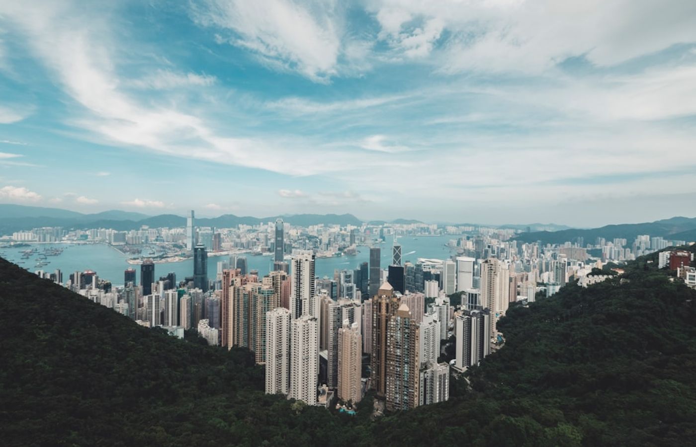

Almost everyone rides the Peak Tram. Walking up the Lung Fu Shan Morning Trail costs nothing, takes about 75 minutes, and delivers the Victoria Harbour view in stages rather than all at once. From the top of the Central-Mid-Levels Escalator you head up Conduit Road to Hatton Road, where the Morning Trail begins as a shaded concrete path that Hong Kong residents use at dawn.
The full walk from Central MTR Station to the Peak Tower is about 4 km with 450 m of ascent, roughly 1.5 hours up and an hour back down. Difficulty: easy to moderate, with a constant gradient but no rough ground. At the top, skip the paid Sky Terrace and walk the 3.5 km Lugard Road and Harlech Road circuit instead - a flat loop around the 552 m summit that the Hong Kong Tourism Board signposts as the Peak Circle Walk, with the postcard harbour panorama from its northern side.
Pro Tip: Walk up and ride green minibus 1 from Peak Galleria back down to Central. It costs about HK$11 with an Octopus card, takes 15 minutes, and skips the 45-minute Peak Tram queue that builds every afternoon.

3Devil's Peak - A Short Climb Through Hong Kong's Wartime Defences


Devil's Peak is the easiest genuinely interesting walk in this guide and the closest to an MTR platform. From Yau Tong Station the route climbs a paved cemetery access road off Ko Chiu Road, then a short flight of steps to a 222 m summit above the Lei Yue Mun channel, the narrow gap every ship entering Victoria Harbour from the east has to squeeze through.
Round trip is 3 km with about 210 m of ascent, and 1.5 hours is enough including time among the ruins. Difficulty: easy. The Gough Battery gun emplacements sit at 160 m and the Devil's Peak Redoubt, built in 1914, crowns the top; both anchored the eastern end of the Gin Drinker's Line that British and Canadian troops defended in December 1941. Adding the Pottinger Battery detour at 81 m stretches the walk to roughly 4 km.
Pro Tip: Come at golden hour. The summit faces west across Lei Yue Mun to Hong Kong Island, and Yau Tong MTR Station is a 30-minute downhill walk, so you can stay for the sunset without worrying about a last bus.
4Lion Rock - Kowloon's Skyline Viewpoint on a Relentless Staircase

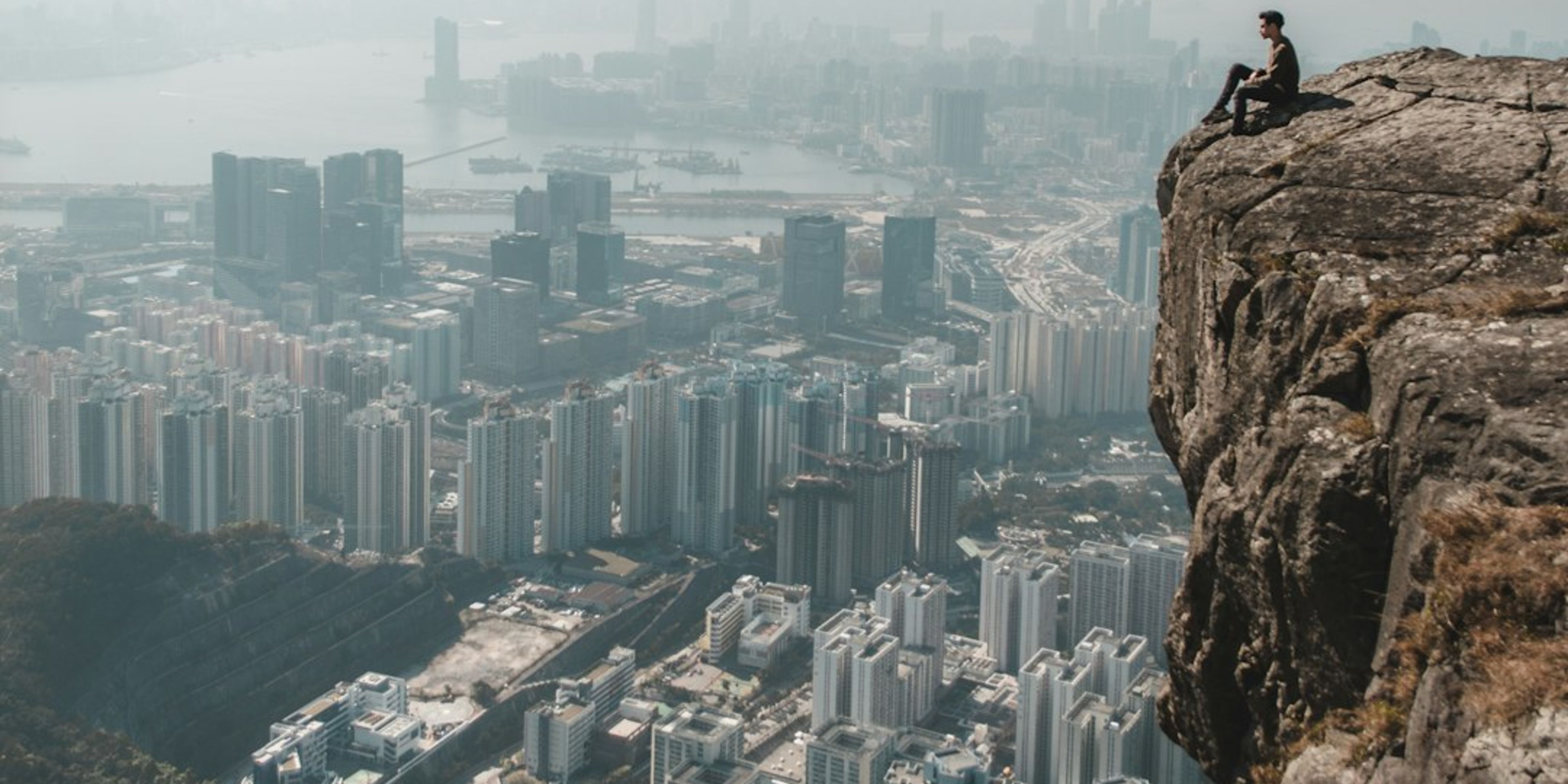
Lion Rock gives you the straight-down view of Kowloon's towers with Victoria Harbour behind them, and it makes you work. The 495 m summit is reached from the Lion Rock Country Park entrance on Sha Tin Pass Road, about an hour of continuous stone staircase from the gate with almost no flat ground in between.
A standard loop back to Wong Tai Sin runs about 6.7 km with 520 m of elevation gain and takes 3.5 to 4 hours with photo stops. Difficulty: moderate to hard, driven by the sustained gradient rather than technical ground. The final scramble onto the lion's head itself is a different proposition: bare exposed rock, no railings, and a long drop on the Kowloon side. Skip it in wind or after rain and settle for the ridge viewpoint, which shows you the same panorama.
Pro Tip: Take green minibus 18M from the stop signposted at Wong Tai Sin MTR Exit B3 instead of walking the 40 minutes of road up to the country park gate. It costs about HK$6 and saves you 150 m of pointless ascent on tarmac.
5High Junk Peak Country Trail - A Sharp Little Summit Over Clear Water Bay

High Junk Peak, or Tin Ha Shan, is a 344 m cone that looks twice its size from the road. The High Junk Peak Country Trail starts at the pavilion opposite the Ng Fai Tin bus stop on Clear Water Bay Road and runs along a ridge with Sheung Sze Wan and Po Toi O below, the Clear Water Bay peninsula ahead and the Ninepin Group islands offshore.
Walking as far as Sheung Sze Wan covers about 4 km with 300 m of ascent in 2 to 2.5 hours; continuing the full country trail to Tai Miu at Po Toi O adds another 3 km. Difficulty: moderate on the main path. The summit itself is optional and steep, a loose rocky spur with hand-scrambling near the top that turns treacherous when wet, and the ridge viewpoints below deliver most of the reward without the risk.
Pro Tip: Finish at Po Toi O and eat at one of the two seafood places on the pier before catching green minibus 16 back to Po Lam MTR. Order the steamed garoupa and reckon on about HK$250 per head, roughly EUR 29.
6Tai Mo Shan - Hong Kong's Highest Peak Without the Scrambling
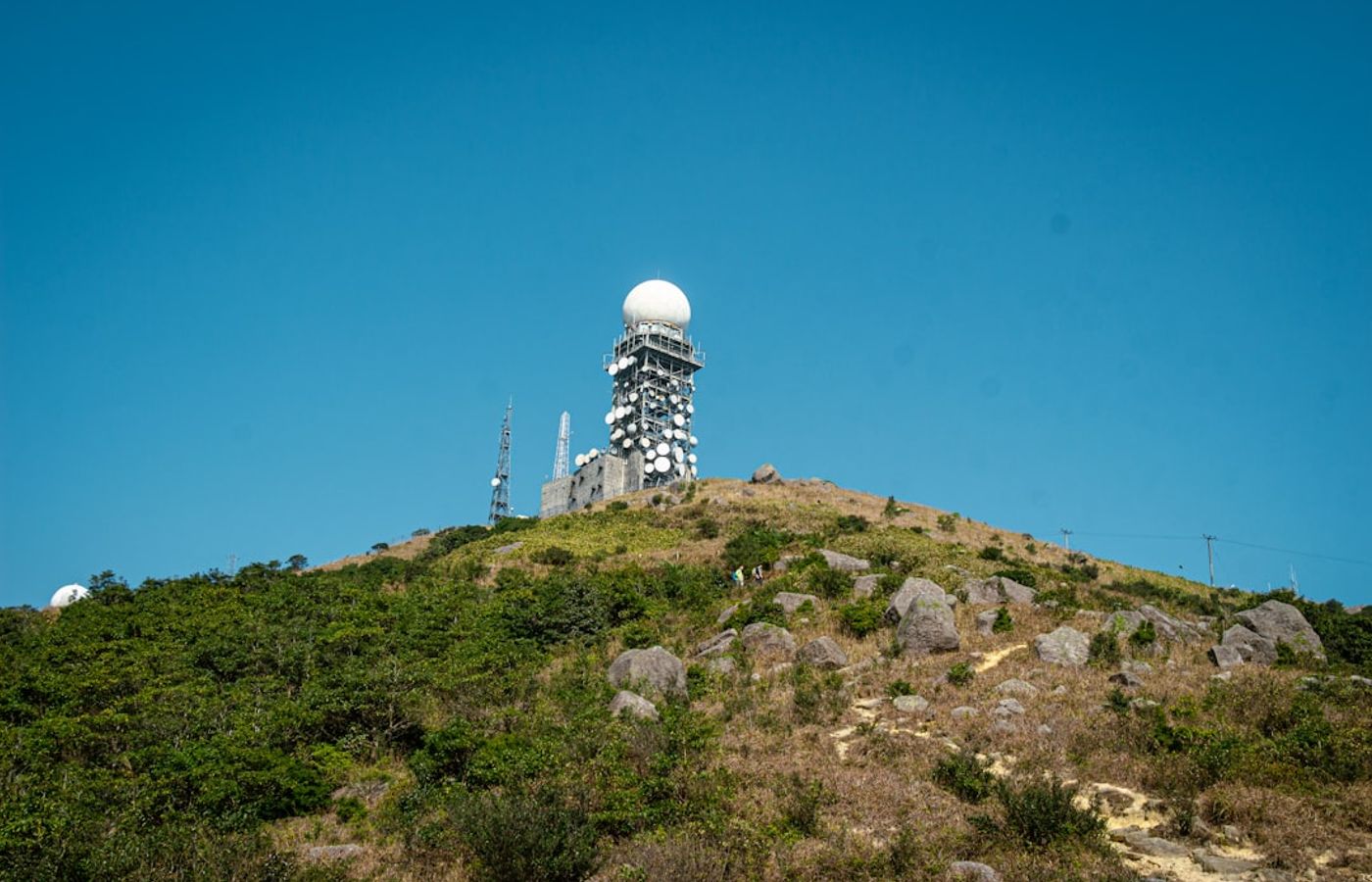
At 957 m, Tai Mo Shan is the highest point in Hong Kong, and the route up it is the least technical big climb in the territory. From the Tai Mo Shan Country Park Visitor Centre off Route Twisk the walk follows MacLehose Trail Section 8 and then the paved Tai Mo Shan Road all the way to the top, so the surface is never in question and navigation is trivial.
Return from the visitor centre is about 9 km with 480 m of ascent and takes 3 to 3.5 hours. Difficulty: moderate, sustained rather than steep. Starting lower, from the Route Twisk bus stop, pushes it past 10 km. A weather radar station occupies the true summit, so the civilian high point sits at roughly 945 m. Bring a layer: the peak runs 5C to 6C colder than Tsim Sha Tsui, sits inside cloud for much of the year, and is where Hong Kong's rare frost days happen.
Pro Tip: Check the Hong Kong Observatory forecast for Tai Mo Shan specifically before you commit to the day. On a clear winter morning you can see Shenzhen; in mist you climb 480 m for a view of grey nothing.
7Pat Sin Leng - Eight Peaks in a Row Above Plover Cove

Pat Sin Leng means Ridge of the Eight Immortals, and the traverse strings eight named summits between 489 m and 590 m along one exposed crest above Plover Cove Reservoir. Most hikers walk it as a 12 km point-to-point on Wilson Trail Section 9, starting at Hok Tau Reservoir near Fanling and finishing at Tai Mei Tuk, or reverse the direction from the Pat Sin Leng Nature Trail trailhead on Tai Mei Tuk Road.
Total ascent is about 940 m across roughly 5 hours, taking in the 639 m Wong Leng, the highest point on the ridge. Difficulty: hard. Nothing is technical, but eight up-and-down cycles of stone staircase punish tired legs and the crest has almost no shade and no water. The Agriculture, Fisheries and Conservation Department's Enjoy Hiking site publishes the section maps and distance-post numbers for the whole Wilson Trail, which is worth downloading before you start.
Pro Tip: Walk it east to west from Tai Mei Tuk to Hok Tau so the afternoon sun is behind you, then take green minibus 52B from Hok Tau Road to Fanling MTR. Fill every bottle at Tai Mei Tuk; there is no water for the next four hours.
8Ma On Shan and the Hunch Backs - The Most Dramatic Ridge in the New Territories

Ma On Shan is the hike people remember from Hong Kong, and the one that generates the most rescue calls. From the Ma On Shan Country Park barbecue site the route climbs to Tiu Shau Ngam at 589 m, crosses the Hunch Backs at 677 m, reaches the 702 m Ma On Shan summit, then descends over Pyramid Hill at 536 m to the Ngong Ping plateau and out towards Sai Kung town.
Reckon on 7.5 km and 4.5 to 6 hours for roughly 800 m of ascent. Difficulty: very hard. About 3 km of that distance is unmaintained rock with steep loose ground and real exposure on the Hunch Backs traverse, where a slip has consequences. Gloves help; hiking poles help more on the descent. Do not attempt it in rain or strong wind, and do not start after 1pm in winter, because the ridge offers no escape route once you are committed to it.
Pro Tip: Finish at Sai Kung town rather than doubling back, then ride green minibus 1 from the Sai Kung Pier terminus to Choi Hung MTR. It runs late, costs about HK$11 and takes 30 minutes, which is exactly the safety margin this route demands.
9Sharp Peak - Hong Kong's Toughest Climb to Its Best Beach

Sharp Peak, or Nam She Tsim, is only 468 m high and it is still the hardest walk on this list. The standard approach starts at the pavilion opposite the Pak Tam Au bus stop on Pak Tam Road, follows MacLehose Trail Section 2 towards Chek Keng, then breaks off up a direct ridge of loose decomposed granite that gains most of its height in under a kilometre.
The full circuit out to Tai Long Wan and back is 12.1 km with 770 m of ascent and takes 5 to 6 hours. Difficulty: very hard, and the summit ridge is the reason. It is steep enough that many hikers descend it seated, and the surface slides underfoot. What you get for it is the view down onto the four beaches of Tai Long Wan, part of the Hong Kong UNESCO Global Geopark, and a swim at Sai Wan or Ham Tin afterwards.
Pro Tip: Walk out to Sai Wan and pay for the sampan back to Sai Kung town, about HK$150 or roughly EUR 17 once the boat fills. It removes two hours of walking from the end of an already brutal day.
10Lantau Peak - The Sunrise Climb Above Ngong Ping
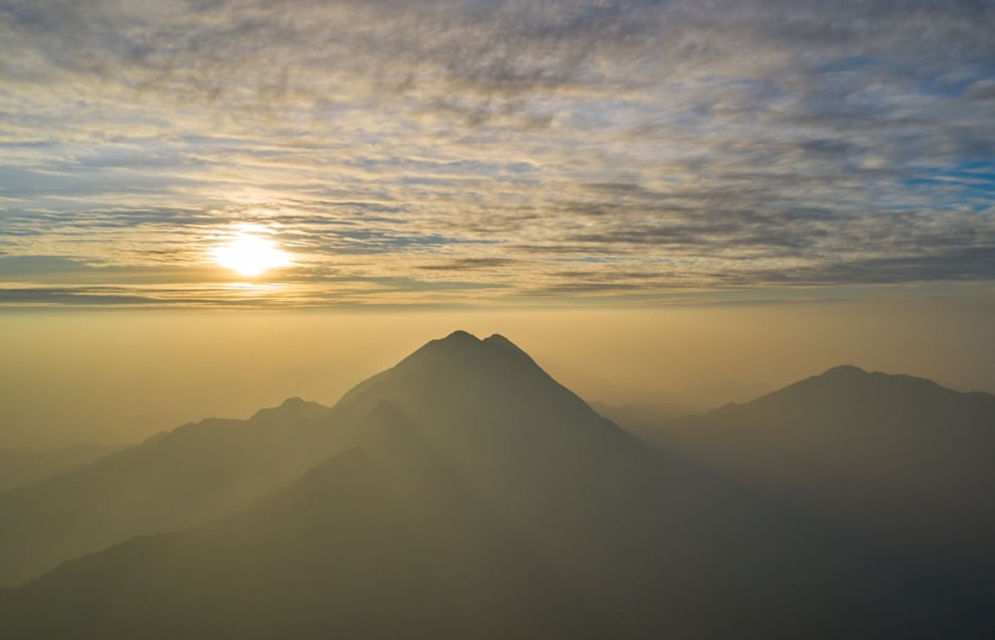
Lantau Peak, known locally as Fung Wong Shan, is the second-highest summit in Hong Kong at 934 m and the classic sunrise objective. Lantau Trail Section 3 runs 4.3 km from the Pak Kung Au bus stop at 325 m up to Ngong Ping, climbing 609 m over three consecutive staircase hills before dropping towards the Tian Tan Buddha. Add the walk into Ngong Ping village and the day is about 6 km and 3 to 4 hours. Wikipedia's Lantau Peak entry covers the geology and the Buddhist history of the mountain.
Difficulty: hard. The steps are relentless and there is no shade at any point on the climb, which is why heat exhaustion cases here spike between June and September. Carry two litres of water minimum. For sunrise, hikers either overnight at the Ngong Ping campsite or leave Pak Kung Au around 4am with head torches, then watch the light come up over the Pearl River Delta.
Pro Tip: Descend to Ngong Ping and ride the Ngong Ping 360 cable car down to Tung Chung MTR instead of walking out. A one-way standard cabin runs about HK$235 in 2026, roughly EUR 27, and the 25-minute crossing above the Tung Chung valley is worth every dollar on wrecked legs.
Get hotel deals for Hong Kong
Price drops, new stays and local tips for Hong Kong, straight to your inbox.
No spam, unsubscribe anytime.

CEO and co-founder
Tomas is the co-founder and director of trip1, an European company specializing in reservation services. He launched the company in 2025 with a focus on building scalable, efficient operations.
10 Best Hikes in Hong Kong - FAQ
Dragon's Back, Section 8 of the Hong Kong Trail. From To Tei Wan on Shek O Road it climbs onto an undulating ridge over Tai Tam Bay and Shek O, tops out at 284 m on Shek O Peak, then drops to Big Wave Bay: 7.6 km in 2.5 to 3 hours. It is easy to moderate, but hundreds of people share the ridge on Sunday mornings, so start early.
Dragon's Back is the classic ridge walk, 7.6 km from To Tei Wan to Big Wave Bay with sea views both sides. For the harbour view, walk from Central up the Lung Fu Shan Morning Trail to Victoria Peak, about 4 km and 450 m of ascent, then loop Lugard Road and Harlech Road. Both are easy to moderate, and green minibus 1 takes you back down to Central.
Ma On Shan over the Hunch Backs and Sharp Peak are the hardest of the popular routes, both very hard. Ma On Shan covers 7.5 km and about 800 m of ascent, with 3 km of exposed, loose rock. Sharp Peak's 12.1 km circuit gains 770 m, and its summit ridge is so steep that many hikers descend it seated. Avoid both in rain or strong wind.
The MacLehose Trail, at 100 km in 10 sections across the New Territories, from Pak Tam Chung in Sai Kung to Tuen Mun, crossing eight country parks. Section 2 reaches the Tai Long Wan beaches and Section 8 passes Tai Mo Shan. Like the Hong Kong, Wilson and Lantau trails, it has distance posts every 500 metres with codes you can read to the 999 operator to give your exact position.
October to March. From May to September, humidity of 85 to 95 per cent and highs near 33 C turn staircase climbs such as Lantau Peak, Pat Sin Leng and Lion Rock into heat-exhaustion risks, and typhoon season falls in the same months. The dry months have their own catch: hill fire danger warnings are frequent from November to April, so never light a stove outside barbecue sites.
No. Country park trails in Hong Kong are free and need no permit or booking. What you must check is the Hong Kong Observatory: at a red or black rainstorm warning, get off ridges and out of streambeds, and typhoon signal No. 8 or above closes country park facilities and stops most buses and ferries. The AFCD Enjoy Hiking site has maps and safety notes.