Guides · Malaga
5 Best Hiking Trails in Malaga
CEO and co-founder
Malaga hiking brings together some of the most dramatic terrain in southern Spain - limestone gorges carved by rivers, karst rock formations that look like alien geography, river canyon walks through shallow water, and cliff-side paths that were originally industrial infrastructure. This guide covers the 5 best hiking trails in Malaga province, from the world-famous Caminito del Rey walkway above the El Chorro gorge to a gentler river trail through the Nerja hinterland that requires waterproof footwear rather than any technical skill.
Each trail entry includes the starting point address, distance, elevation gain, difficulty, transport access from Malaga city, and a Pro Tip. The trails spread from the western end of Malaga province (El Chorro, 60 km northwest) through the centre (El Torcal, 50 km north) to the eastern Axarquia coast (Nerja and Frigiliana, 52-60 km east). A hire car from Malaga city (Aeropuerto de Malaga - Costa del Sol, AGP, or central rental agencies) gives you the most flexibility. Caminito del Rey is the only trail that must be booked weeks in advance.
Best season: spring (March to May) and autumn (October to November) offer the best combination of comfortable temperatures and full trail access. Summer hiking (June to August) is possible but requires early starts before 9 AM to beat the heat on exposed trails.
1Caminito del Rey - Spain's Most Dramatic Gorge Walkway
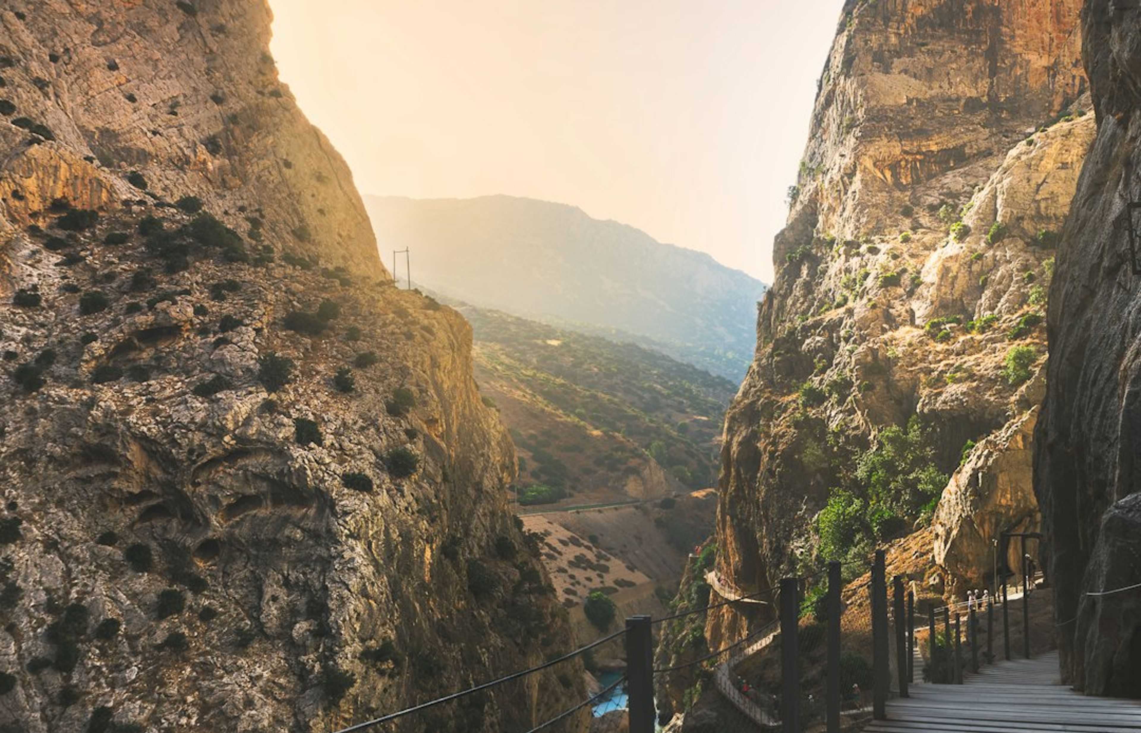
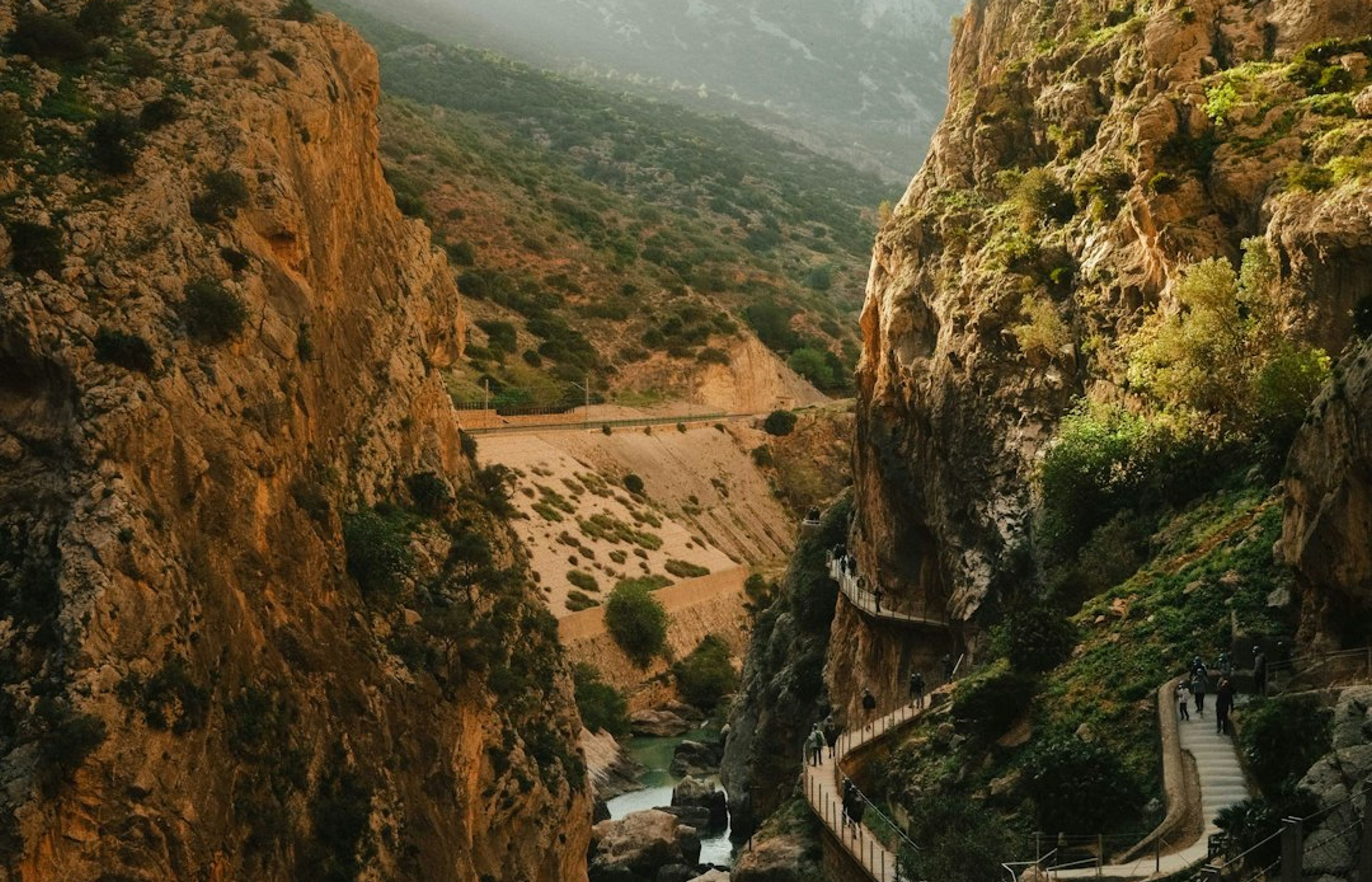
Caminito del Rey (Camino del Rey, Ardales) is the most dramatic hiking trail in Andalusia and one of the most remarkable in Europe - a 7.7 km route along a narrow wooden boardwalk pinned to the vertical walls of the El Chorro gorge, 100 metres above the Guadalhorce river. The original concrete walkway was built in 1901-1905 for workers maintaining the hydroelectric infrastructure and fell into disrepair; the restored route reopened in 2015 with a new wooden boardwalk and full safety railings. The gorge walls close to within 10 metres at some points, with the boardwalk traversing vertical limestone faces and passing through a tunnel.
The route runs north to south: enter at the northern entrance (Ardales) and exit at the southern exit (El Chorro village). Total distance is 7.7 km with about 3-4 hours hiking time. The first 3 km are easy walking through the Valle del Hoyo before the gorge section begins. Tickets cost 10 EUR and must be booked online at caminodelrey.info - sell out 2-4 weeks ahead in spring and autumn.
Pro Tip: Book the 9 AM entry slot - the gorge light is best in the morning when the sun hits the upper limestone walls. The gorge section begins at km 3 and the most dramatic views are from the highest boardwalk sections above the river. Wear trainers with good grip; the boardwalk has metal grille sections that can feel unsteady until you're used to them.
2El Torcal de Antequera - Malaga's Extraordinary Karstic Landscape
El Torcal de Antequera is a karstic limestone massif 50 km north of Malaga that has been eroded into one of the strangest landscapes in Europe - towers, columns, and mushroom-shaped limestone formations up to 15 metres high, scattered across a plateau at 1,200 metres altitude. It's a natural park and UNESCO Geopark with three marked circuits: Ruta Verde (1.5 km, 40 min, easy), Ruta Amarilla (3.1 km, 2 hours, moderate), and Ruta Roja (4.7 km, 3 hours, moderate-hard). Access to the plateau area is from the car park at the end of the A-7075 road.
Entry to the park is free; the visitor centre (Centro de Visitantes El Torcal, open daily from 10 AM) has good geological exhibits and sells trail maps. The rock formations are best visited in the late afternoon when low sun creates shadows that accentuate the shapes. Wildlife includes Spanish ibex (Capra pyrenaica hispanica) visible year-round, and griffin vultures (Gyps fulvus) circling above the plateau.
Pro Tip: Combine the Ruta Amarilla (the middle circuit, 3.1 km) with the first section of the Ruta Roja for the best variety of formations and the best viewpoints. The Mirador de las Ventanillas (at the junction of the two routes, approximately halfway through) has the most iconic view - looking out over the limestone plateau towards the Malaga coast 50 km away on clear days.

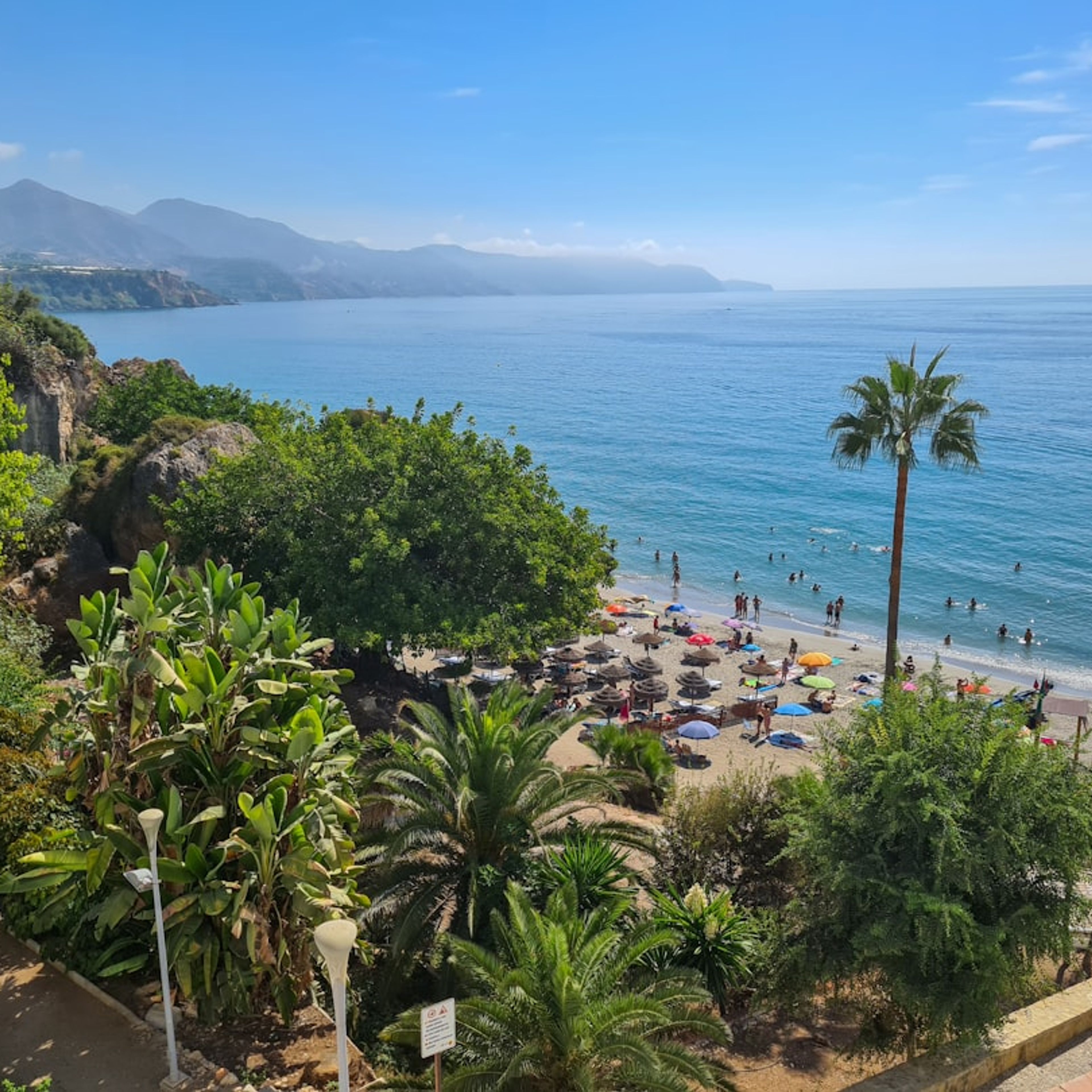
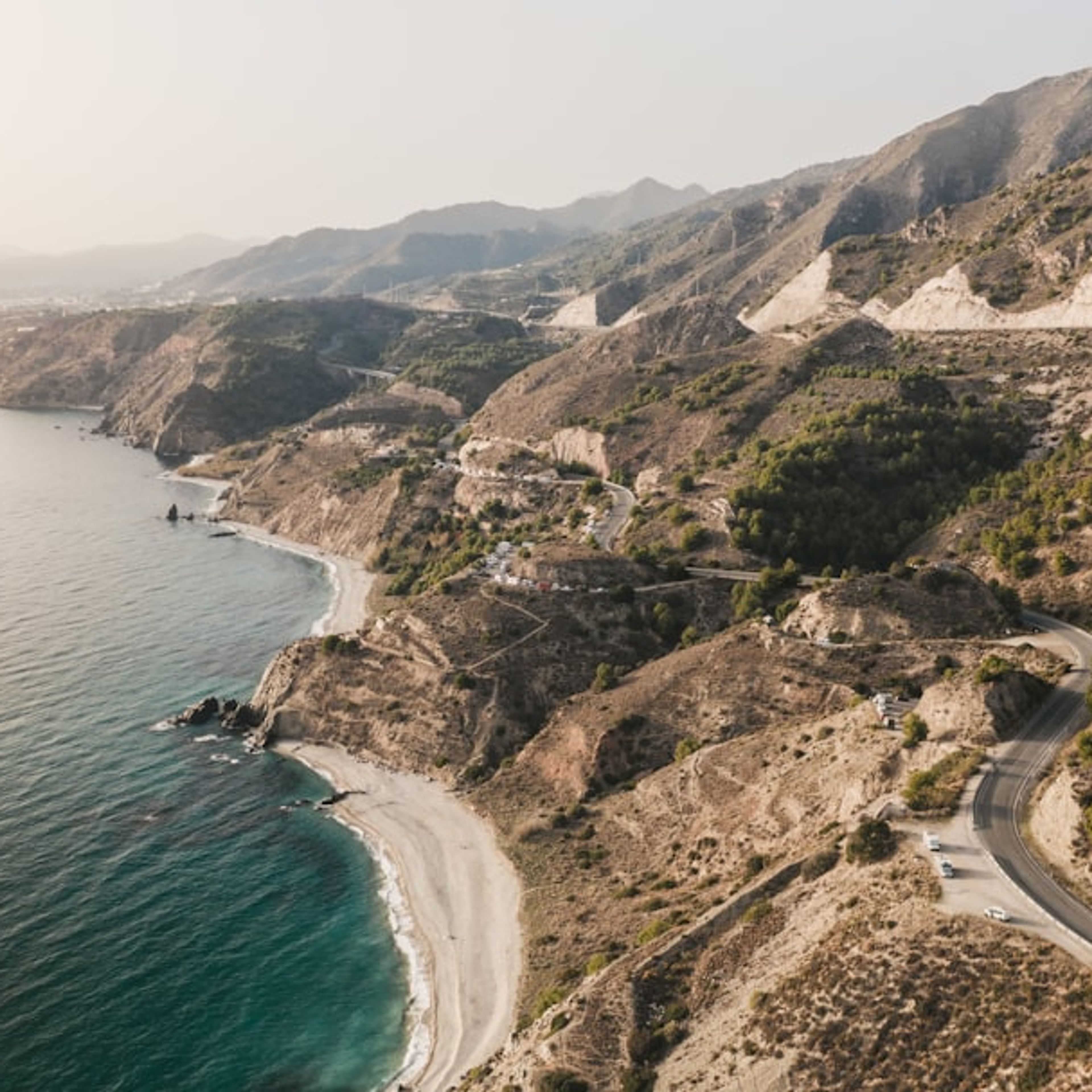
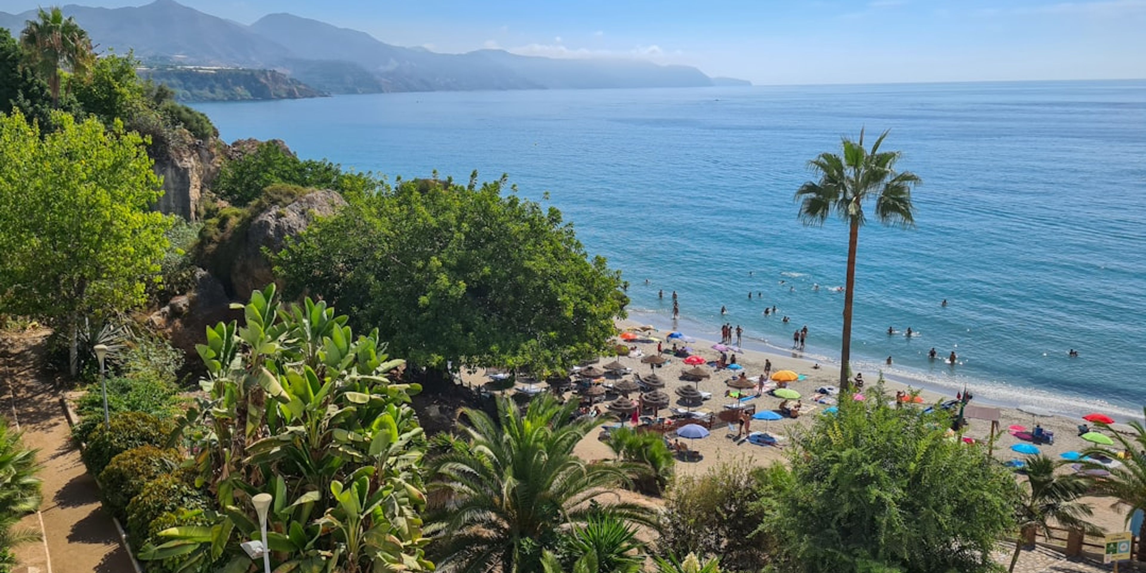
3Rio Chillar River Walk - A Refreshing Canyon Hike Near Nerja
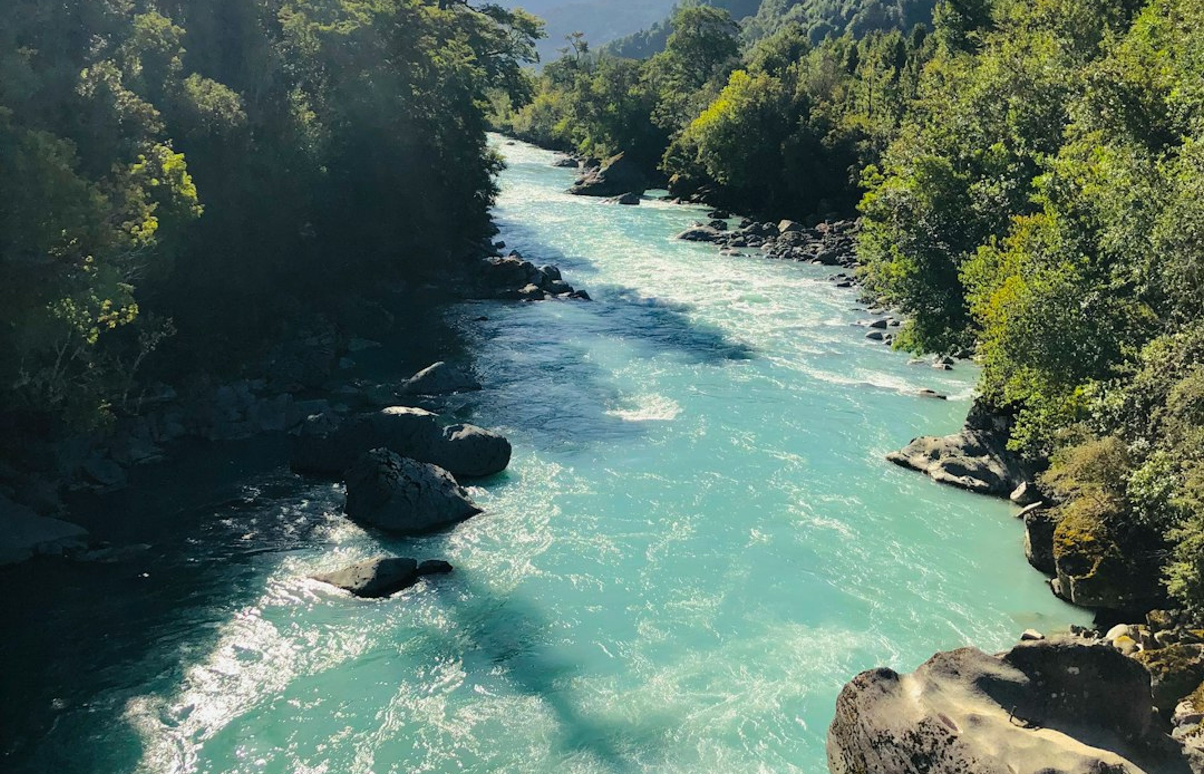
The Rio Chillar river walk (Ruta del Rio Chillar) near Nerja is the most refreshing hike in Malaga province - a 10 km out-and-back route that follows the Chillar river through a narrow limestone canyon, walking in and alongside the river itself. The water is shallow (rarely above knee deep) and the canyon walls close overhead at points to create natural shade. The route ends at the foot of a waterfall and natural pool called El Playazo.
Distance is 5 km each way (10 km return), with negligible elevation change - the river gradient is very gentle. The walk takes 3-4 hours return. Water shoes or old trainers are essential - you'll be walking through water for most of the route. The trailhead is at the Paraje Natural de las Lomas del Rio Chillar parking area on the southern edge of Nerja.
Pro Tip: Leave from the trailhead by 9 AM in July and August - the car park fills completely by 10 AM and latecomers must park 2 km back along the road. The canyon provides shade throughout the walk, making this the most comfortable summer hike in Malaga province. Bring more water than you think you need - the river water is not potable.
4Frigiliana Ridge Walk - A White Village and Mountain Views Above the Coast
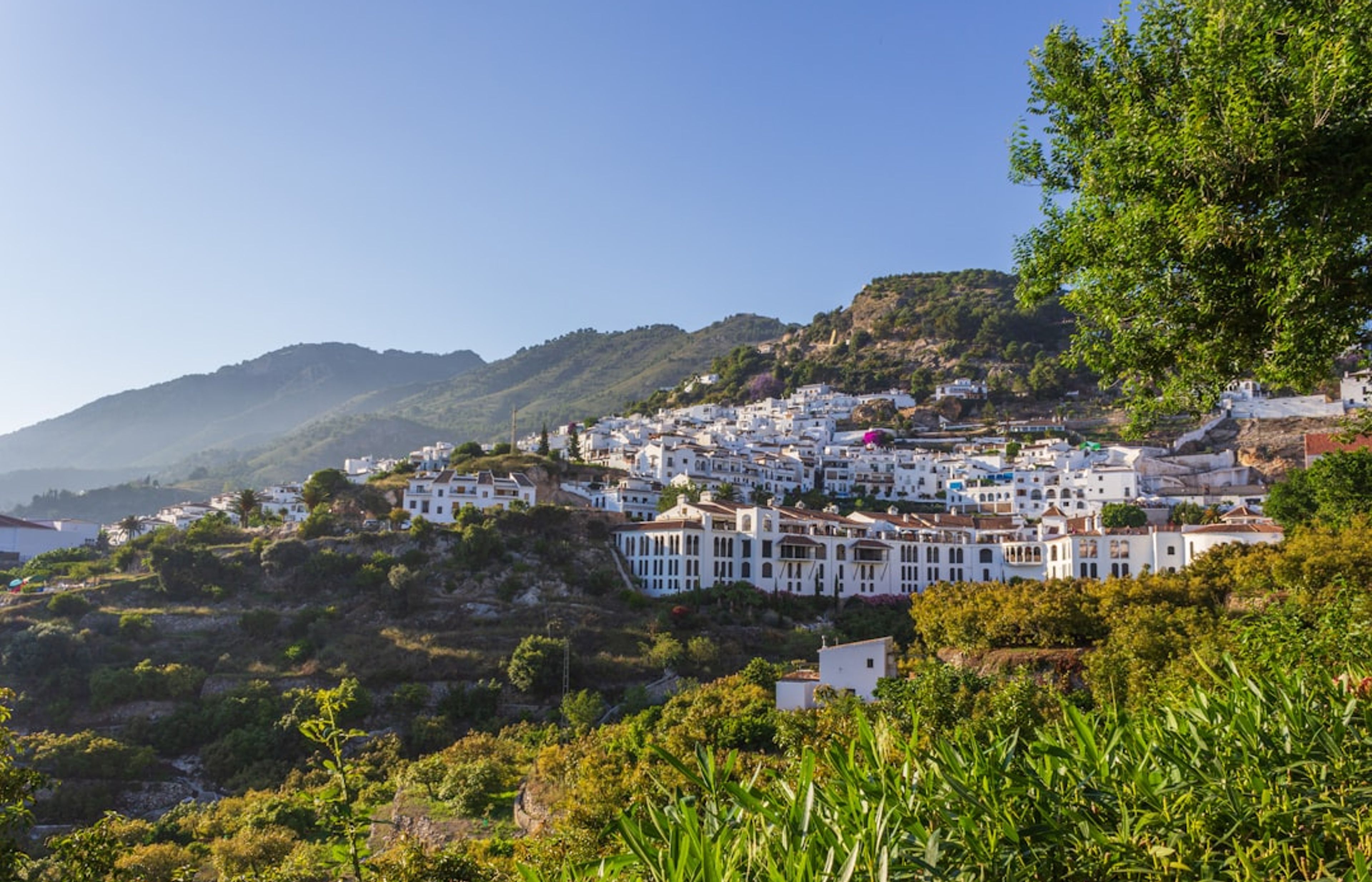
Frigiliana is the best-preserved Moorish village in Malaga province - a tightly clustered white village on a hillside above Nerja, with narrow cobbled streets, tiled murals depicting the 1569 Morisco rebellion, and views down over the coast and to Morocco on clear days. The village itself is worth 90 minutes, but the ridge walk starting from the village (a footpath marked from Plaza de la Iglesia heading north along the Sierra Almijara ridge) gives a full-day hiking option at 1,000+ metres altitude with panoramic views over both coast and interior.
The ridge trail is marked but not formalised - download a GPS track from Wikiloc (search 'Frigiliana Sierra Almijara') before setting out. Distance varies by chosen route from 6 to 15 km; elevation gain from the village is 400-800 metres depending on how far you go. The easier option is simply the 3 km walk to the Mirador de Frigiliana viewpoint (no markings required, follow the main track north from the village).
Pro Tip: Visit the village first (it's most atmospheric before 10 AM when the tour groups from Nerja arrive) then head out on the ridge walk with the coolest part of the day ahead of you. The village bars on Plaza del Ingenio serve excellent desayuno (breakfast) from about 8 AM - espresso and a tostada for 2-3 EUR - and pack sandwiches to order.
5Montes de Malaga Natural Park - Pine Forest Hiking 10 km from the City
The Montes de Malaga Natural Park (Parque Natural Montes de Malaga) is a 5,000-hectare pine forest nature reserve just 10 km north of Malaga city centre - the most accessible hiking from the city itself. The park has 10 marked trails of varying length, from the 2.5 km Sendero de la Fuente del Chaparro (easy, good for beginners) to the 12 km Sendero del Cerro del Aljibe which reaches 1,034 metres and gives views over Malaga, the coast, and on clear days the African Atlas Mountains to the south.
The main visitor centre (Centro de Visitantes Torreon, Carretera de Colmenar km 6.5) has trail maps and is open Tuesday to Sunday from 10 AM. The pine forest was planted in the 1930s on deforested hillsides and now provides a genuinely shaded hiking environment where July temperatures run 5-8 degrees Celsius cooler than the city below.
Pro Tip: The Venta El Tunon restaurant (Carretera de Colmenar km 7, 29013) adjacent to the visitor centre is a traditional Malaga ventas (roadside restaurant) serving grilled meats and local wines at very reasonable prices. Combining a 3-4 hour morning hike with lunch here and a return to Malaga city in the afternoon makes for a very efficient half-day from the city centre.

CEO and co-founder
Tomas is the co-founder and director of trip1, an European company specializing in reservation services. He launched the company in 2025 with a focus on building scalable, efficient operations.
5 Best Hiking Trails in Malaga - FAQ
No. The trails on this list vary from easy 2-hour walks to full-day hikes requiring good fitness. Caminito del Rey is 7.7 km and takes 3-4 hours; El Torcal is a separate day from Malaga city; and the Frigiliana ridge walk and Rio Chillar river walk are each half-day trips. A dedicated 3-day hiking base from Malaga covers all five.
Caminito del Rey (Camino del Rey, Ardales) requires advance booking - tickets sell out weeks ahead in peak season (March to October). Book at caminodelrey.info. El Torcal (Antequera) is free to walk and requires no booking for the standard marked routes. The Rio Chillar river walk (Nerja) and other natural paths are open access.
March to May and October to November are the best hiking months around Malaga. Summer (June to August) brings extreme heat - temperatures above 35 degrees Celsius are common in Malaga province and the exposed trails of Caminito del Rey and El Torcal become uncomfortable. Winter (December to February) is mild for hiking and rarely drops below 10 degrees Celsius.
The Rio Chillar river walk (Paraje Natural de las Lomas del Rio Chillar, Nerja) is the most family-friendly - it follows a river through a gorge and involves walking through shallow water rather than technical climbing. Children from about age 6 can manage it. El Torcal's short circular route (Ruta Verde, 1.5 km) is suitable for young children. Caminito del Rey has a minimum age of 6 but requires some head for heights.
A hire car from Malaga city is the most practical option for all five trails. Caminito del Rey can be reached by train (Malaga Maria Zambrano to El Chorro, Cercanias C2 line, 1 hour) plus a 4 km walk to the trail entrance. Bus services exist but are infrequent and don't cover all the trailheads directly.
Malaga booking help
Common questions about booking hotels in Malaga and paying in crypto on trip1.