
Guides · Ubud
5 Best Hikes Near Ubud

CEO and co-founder
This guide covers the 5 best hikes near Ubud - the walks and treks genuinely worth an early alarm, ordered from a ridge stroll you can start at Ubud Palace to a 2 am volcano summit that legally needs a paid guide. Every entry gives the trail distance in kilometres, the elevation gain in metres, a realistic round-trip time and an honest difficulty rating, plus the exact trailhead address, scooter and Grab transfer times from central Ubud, and fares in both Indonesian rupiah and euros.
The order is built so you can plan a sensible week. Two of these Ubud hiking trails, the Campuhan Ridge Walk and the Sari Organik rice field path, begin within walking distance of Ubud Palace and cost nothing at all. Tegallalang and Jatiluwih are drives of 25 and 90 minutes respectively and both charge entry. Mount Batur sits 40 km north-east and is the only route here where walking alone is neither practical nor safe.
Read the Pro Tips before you go. Bali's heat and humidity mean an unshaded 10 am start on any of these Ubud rice terrace walks is miserable, and the wet season from November to March 2026 delivers heavy afternoon downpours that turn dirt paths and stone steps into slides. Several routes pass village temples and roadside shrines, so cover your shoulders and knees, and expect donation boxes with a person sitting beside them.
1Campuhan Ridge Walk - The Easiest Real Hike in Central Ubud
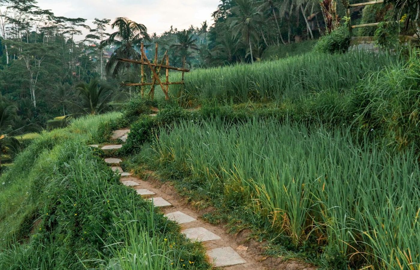

The Campuhan Ridge Walk is the one hike near Ubud you can start on foot from your breakfast table. The path begins beside Pura Gunung Lebah, the eleventh-century temple standing where the Wos Barat and Wos Timur rivers meet, and climbs a narrow paved spine between two river valleys. It runs 2 km out to the village of Bangkiang Sidem and 4 km return, with roughly 90 m of cumulative elevation gain and one short climb at the start. Budget 1.5 to 2 hours return including stops. Difficulty: easy - the surface is concrete and stone the whole way, so trainers are fine.
The walk itself is free, but the costs cluster around the edges. Scooter parking near the Warwick Ibah entrance runs IDR 5,000 (about EUR 0.25) and car parking IDR 10,000 to 20,000 (EUR 0.50 to 1.00). A donation box sits at the temple gate with someone usually beside it; IDR 10,000 to 20,000 is a normal contribution and you are allowed to walk on past. Karsa Kafe at the far end is the traditional turnaround point for a coconut before you retrace your steps.
Pro Tip: Be on the ridge by 06:15. There is zero shade on the spine and by 07:30 it is already past 30C, which is why the 2 km back always feels twice as long as the 2 km out. Cover your shoulders for the temple section at the start.
2Mount Batur Sunrise Trek - The Hardest and Most Tightly Controlled Hike Near Ubud
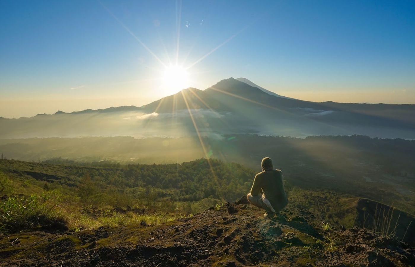

Mount Batur is the only serious climb on this list, and the only one where the rules are written by a local guide association rather than a park service. The standard sunrise route leaves Toya Bungkah on the eastern shore of Lake Batur and covers 3 to 5 km return with about 500 m of elevation gain to the 1,717 m summit. Reckon on 2 to 4 hours return: roughly 1.5 to 2 hours up on loose volcanic scree in the dark, then 1 to 1.5 hours down. Difficulty: moderate on paper, harder in practice because you are doing it by torchlight on no sleep. Mount Batur is an active volcano inside a much larger caldera, and the summit still vents steam through cracks you will feel through your shoes.
Now the part most guides skip. Hiking Batur independently is not realistic. Access is controlled by the HPPGB, the local Batur trekking guide association, and hikers who have set off alone report being blocked, shouted at and in some cases physically confronted on the trail. Expect to pay IDR 400,000 to 600,000 per person, roughly EUR 20 to 29, for a group trek from Ubud including hotel pickup, a guide and a torch; private treks cost considerably more. Pickup from central Ubud falls between 01:30 and 02:30 for the 40 km, 60 to 90 minute drive, with walking starting around 03:30.
Pro Tip: Book through your accommodation the day before rather than at a roadside desk - you will pay closer to IDR 400,000 than IDR 600,000 and the pickup actually arrives. Pack a fleece: the summit sits at 1,717 m and drops to about 12C before dawn, which nobody plans for in Bali.

3Jatiluwih Rice Terraces - The UNESCO-Listed Subak Walk
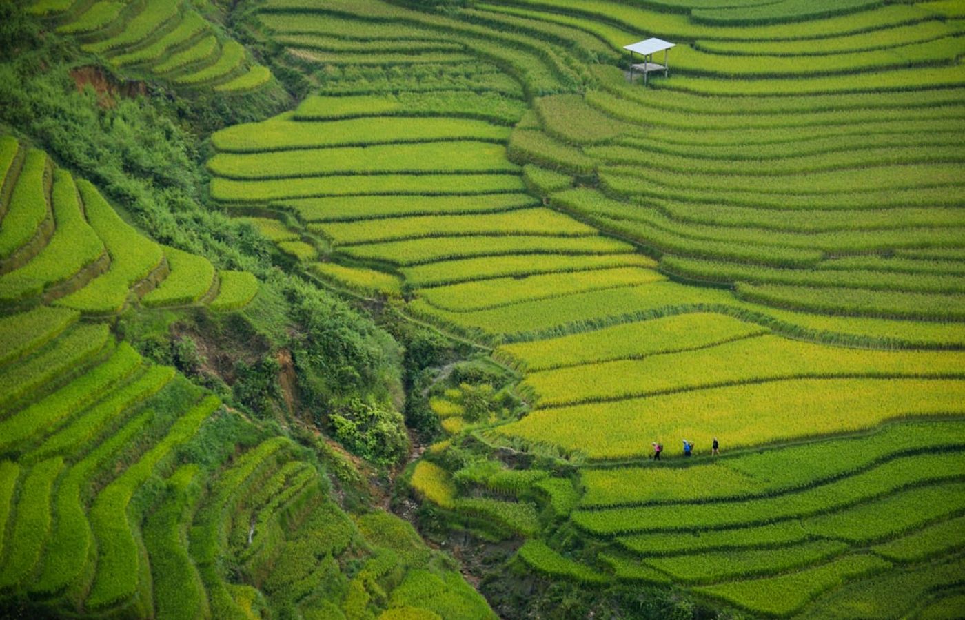

Jatiluwih delivers the best rice terrace walking in Bali and the shortest selfie queues. The terraces form part of the Catur Angga Batukaru area inscribed by UNESCO in 2012 as the Cultural Landscape of Bali Province: the Subak System, the thousand-year-old cooperative water temple network that still decides which paddy gets irrigated and when. Five colour-coded routes fan out from the ticket office; stitching the red and blue loops together gives you about 4 km with roughly 125 m of cumulative elevation gain, and takes 1.5 hours at a photo-stopping pace. Difficulty: easy, with continuous gentle ups and downs on concrete farm paths and earth bunds between the paddies.
Entry in 2026 is IDR 50,000 per person, about EUR 2.45, plus IDR 3,000 scooter or IDR 5,000 car parking, and the gates open 08:00 to 18:00. Jatiluwih sits 40 km from central Ubud and the drive takes 1 hour 15 to 1 hour 30 by car, or a similar stretch by scooter on roads that turn narrow and steep around Petang. A one-way Grab car costs roughly IDR 250,000 to 350,000 (EUR 12 to 17) if you can find a driver willing to take the distance; most visitors hire a car and driver for the day at around IDR 700,000, about EUR 34.
Pro Tip: Walk the loops anti-clockwise from the northern car park so the terraces are backlit for your first hour. Do not stride past the small subak channels beside the path - those irrigation ditches are the reason this landscape is UNESCO-listed rather than merely pretty.
4Tegallalang Rice Terraces Walk - Beautiful, and Heavily Commercialised
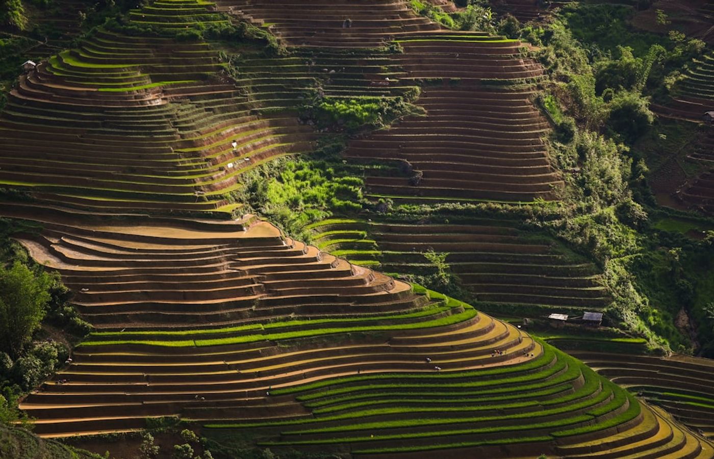
Tegallalang is genuinely beautiful and it is also the most commercialised patch of farmland in Bali. You should know both before you go. The walking loop drops from the roadside viewpoints on Jalan Raya Tegallalang down through the paddies to the valley floor and climbs the far side: about 2 km, 80 to 100 m of descent and the same again back out, and 45 to 75 minutes depending on how often you stop. Difficulty: moderate, entirely because of the surface - narrow dirt paths and steep uneven stone steps with no handrail, treacherous for hours after rain.
The money arrives in layers. Official entry at the main gate is IDR 15,000 to 20,000 (EUR 0.75 to 1.00) with parking at IDR 2,000 to 5,000. Then, on the trail itself, a run of unofficial donation posts asks a further IDR 10,000 to 20,000 each to let you cross private land, and there can be three or four on one loop. The swings and nests strung across the valley charge IDR 250,000 to 400,000 per person (EUR 12 to 19.50), with costume rental adding IDR 150,000 to 250,000. All of it is optional and none of it is signposted before you commit. Tegallalang lies 10 km north of Ubud, a 20 to 25 minute scooter ride or a Grab car at IDR 70,000 to 100,000 one way, EUR 3.40 to 4.90.
Pro Tip: Carry about IDR 100,000 in 10,000 and 20,000 notes so you can pay the donation posts without handing over a 100,000 note and waiting for change that never comes. Arrive at 06:30: the tour coaches land from 09:00 and the loop is single-file in both directions.
5Sari Organik and Subak Sok Wayah Trail - The Quiet Rice Field Walk from Ubud Palace
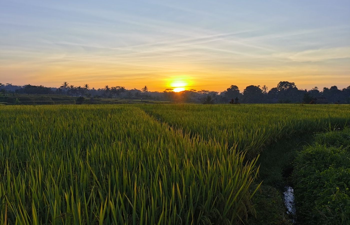
The Sari Organik path, properly the Subak Sok Wayah trail, is where locals send you when you say the Campuhan ridge was too busy. It leaves Jalan Raya Ubud roughly 900 m west of Ubud Palace, turns north onto a concrete irrigation-channel path and heads straight out into working rice fields: 3.5 km out and back, barely 40 m of elevation gain, and about an hour at a slow pace. Difficulty: easy and almost entirely flat, though the path is only wide enough for one person and local scooters do use it, so listen behind you.
It is free, with no gates and no donation boxes, which makes it the best-value entry on this list of Ubud hiking trails. The cafes along the way - Sari Organik itself, The Rice Joglo, Cafe Pomegranate - are why most people are out here at all. Turn around near The Rice Joglo; the trail beyond narrows and gets overgrown, and the connecting paths east towards the Subak Juwuk Manis fields are rough rather than adventurous. You can reach the trailhead on foot from anywhere in central Ubud in under 15 minutes, so no transfer and no fare is needed.
Pro Tip: Do this one at 16:30 rather than dawn. The fields face west, the light is better, and unlike the exposed Campuhan ridge you get treeline shade for the first kilometre. In the wet season, November to March, be off the path by 17:30 - the concrete channel edges turn slick and there is no lighting whatsoever.
Get hotel deals for Ubud
Price drops, new stays and local tips for Ubud, straight to your inbox.
No spam, unsubscribe anytime.

CEO and co-founder
Tomas is the co-founder and director of trip1, an European company specializing in reservation services. He launched the company in 2025 with a focus on building scalable, efficient operations.
5 Best Hikes Near Ubud - FAQ
The Campuhan Ridge Walk, for an easy start: a free, paved 4 km return path from Pura Gunung Lebah that takes 1.5 to 2 hours and is best walked by 06:15, before the heat. For a quieter rice field walk, take the flat Sari Organik trail. For a real climb, the Mount Batur sunrise trek is the hardest and most rewarding, but it needs a paid guide.
The Mount Batur sunrise trek. Group treks pick you up in Ubud between 01:30 and 02:30, start walking around 03:30 from Toya Bungkah and reach the 1,717 m summit of the active volcano for sunrise. The route is 3 to 5 km return with about 500 m of climbing, and the local guide association controls access, so you must go with a guide.
Moderate, but harder than the numbers suggest. You climb about 500 m in 1.5 to 2 hours on loose volcanic scree, in the dark and on very little sleep, then take 1 to 1.5 hours to come down. Anyone with average fitness can manage it at the guide's pace. Shoes with good grip matter more than speed, because the scree slides underfoot on the way down.
Yes, on a clear morning. Watching the sun rise over the caldera and Lake Batur from the top of an active volcano, with steam venting through cracks in the ground, is one of the highlights of Bali. The catch is cloud: in the wet season, from November to March, low cloud often hides the sunrise, so the dry months from April to October give you the best odds.
Layers. The 1,717 m summit drops to about 12C before dawn, so bring a fleece or light jacket over a T-shirt, even though you will sweat on the way up. Wear trainers or hiking shoes with good grip for the loose scree, not sandals. Group treks supply a torch, but carry a small bag with water and your spare layer.
April to October, the dry season. From November to March, heavy afternoon downpours make the stone steps at Tegallalang and the earth paths at Jatiluwih slippery, and low cloud often hides the Batur sunrise. In any month, start walking by 06:30: the Campuhan ridge has no shade at all and is already past 30C by 07:30.