

Guides · Queenstown
5 Best Solo-Friendly Hikes Near Queenstown

CEO and co-founder
This guide ranks 5 solo-friendly hikes near Queenstown that you can walk on your own without a partner, a guide or a rental car. Every trail here was chosen against the same four tests: the route is signposted well enough that you never have to navigate, you will pass other walkers regularly through the day, there are no river crossings or unmarked sections, and you either hold mobile coverage or stay close enough to town to walk out. Four of the five start on an Orbus bus route or within 20 minutes on foot of the Lake Wakatipu waterfront in central Queenstown.
Each entry gives the trail distance in kilometres, the elevation gain in metres, a realistic round-trip time and a difficulty grade, plus the exact trailhead address, the nearest Orbus stop and how far the start sits from the town centre. Every description also explains what specifically makes that trail workable alone - foot traffic, signage, phone reception, bail-out points - and closes with a Pro Tip written for someone walking without a second pair of eyes. Solo hiking Queenstown trails is less a question of fitness than of margin for error, so the practical detail matters more here than the scenery does.
The order is built so you can stack them across a few days. The two town hills, Queenstown Hill and the Tiki Trail, are walkable straight from your accommodation. The Frankton Track and the Sunshine Bay Track follow the Lake Wakatipu shoreline in opposite directions and are flat enough for a first day or a bad forecast. Lake Hayes sits 20 minutes out on the Route 2 bus. Whichever you pick, leave your intentions with someone before you start - the New Zealand Mountain Safety Council's free Plan My Walk app is the simplest way to do it, and every entry below flags the reception and daylight reality for 2026.
1Queenstown Hill Time Walk - The Best Solo Climb You Can Start On Foot From Town
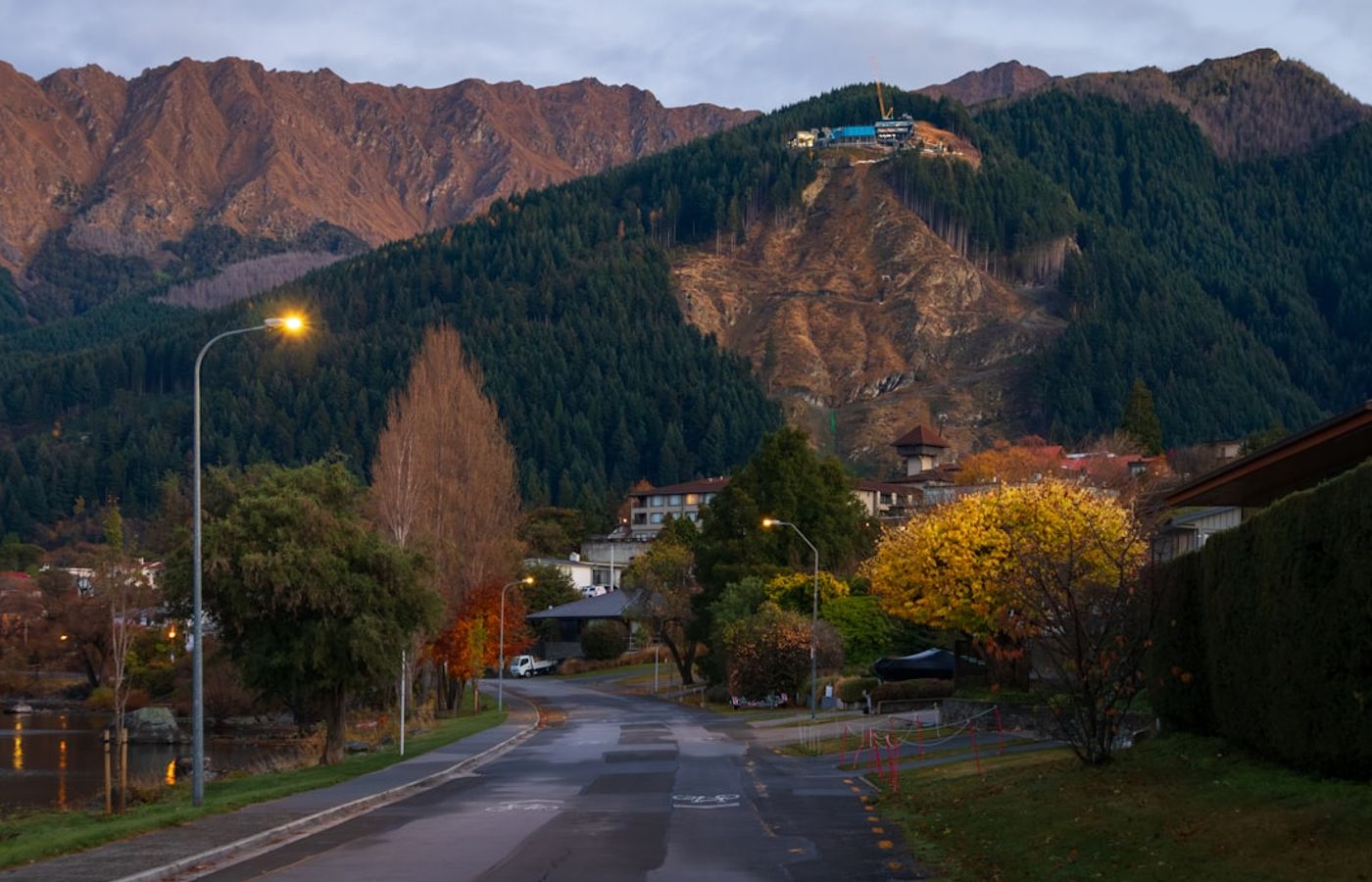

The Queenstown Hill Time Walk is the hike to do on your first clear morning alone. The track climbs 2.5 km from a small car park on Belfast Terrace to the 907 m summit of Te Tapu-nui, gaining roughly 500 m of elevation - closer to 600 m if you walk up from the Lake Wakatipu waterfront rather than driving to the trailhead. Allow 2 to 3 hours return for the 5 km round trip. Queenstown Lakes District Council, which maintains the track, grades it intermediate, and that grade is honest: the ascent is a steady incline through pine and beech with almost no flat sections.
What makes it work solo is the foot traffic and the sightlines. From mid-morning you will pass walkers every few minutes in both directions, and because central Queenstown sits directly below you for most of the climb, you always know which way is down. It is a single benched track with no junctions to misread. Mobile coverage holds nearly the whole way, since the town's cell sites are in line of sight, which is unusual for a hill this size and the main reason it beats other climbs for a first solo outing. Six interpretive panels break the ascent into stages, and the Basket of Dreams sculpture, about 20 minutes below the top, is a natural turnaround point if cloud drops or your legs go. Queenstown Hill is closed to dogs and bikes, so the track stays quiet underfoot. Message someone your route and your expected return time before you set off.
Pro Tip: Skip the Belfast Terrace car park entirely - it holds around eight cars and is full by 9am through the 2026 summer. Walk up from the waterfront via Gorge Road and York Street instead. It adds 20 minutes, gives you a warm-up, and removes the parking gamble from a trip you are already doing on your own.
2Tiki Trail - A Steep Forest Climb With a Gondola Escape Hatch
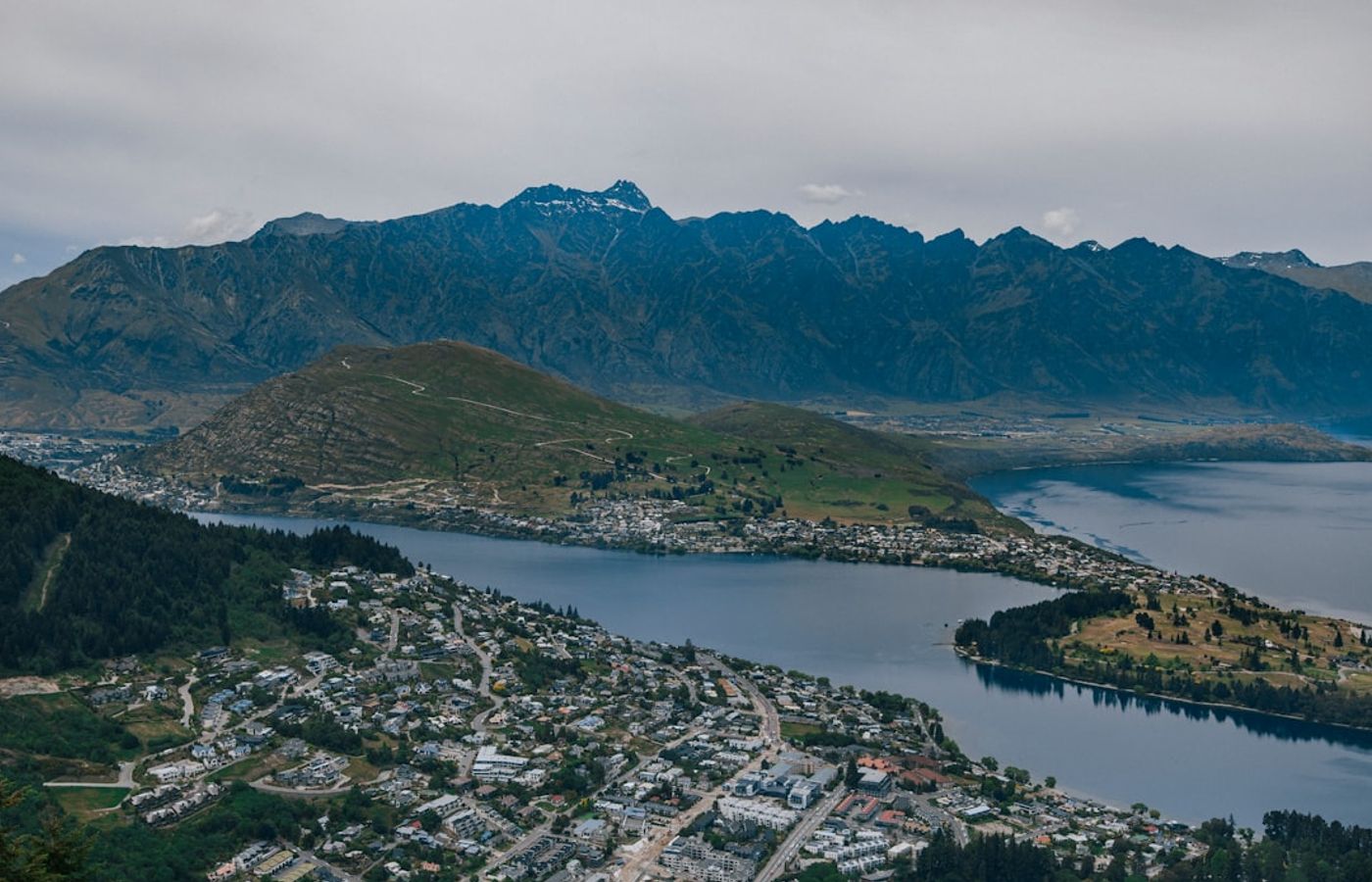

The Tiki Trail is the busiest walking track in Queenstown and the only climb in this guide with a built-in escape hatch. It runs 2.1 km from the end of Cemetery Road, beside the Skyline Queenstown gondola base on Brecon Street, up through pine forest to Bob's Peak at 790 m, gaining 480 m of elevation. Reckon on an hour up and 40 minutes down, so 4.2 km and roughly 2 hours return. Skyline grades it moderate to hard, and the steep, root-crossed sections near the top earn that grade.
For a solo hiker the appeal is the finish rather than the climb. The top is a staffed complex with toilets, drinking water and a cafe, and one-way gondola tickets are sold inside - so if a knee goes, the weather turns, or you have misjudged the light, you ride down instead of descending a steep forest track in the dark. Reception is at full strength the entire way because the summit carries broadcast infrastructure. The Ben Lomond Track continues from Bob's Peak, and it belongs in a different category: 14 km return, 1,438 m of gain to a 1,748 m summit, rated advanced, with the section above Ben Lomond Saddle at 1,326 m unmaintained and carrying steep drop-offs. Read the Department of Conservation track page before you consider that one alone. Ben Lomond is the step up from this list, not a solo warm-up on it.
Pro Tip: Buy the one-way gondola descent at the top complex rather than pre-booking a return ticket, and start climbing no later than 3pm in June or July. Sunset in Queenstown is around 5:10pm in mid-winter and the pine forest on the Tiki Trail goes dark well before the sun actually drops.

3Frankton Track - A Flat Lakeside Walk That Never Leaves Phone Coverage
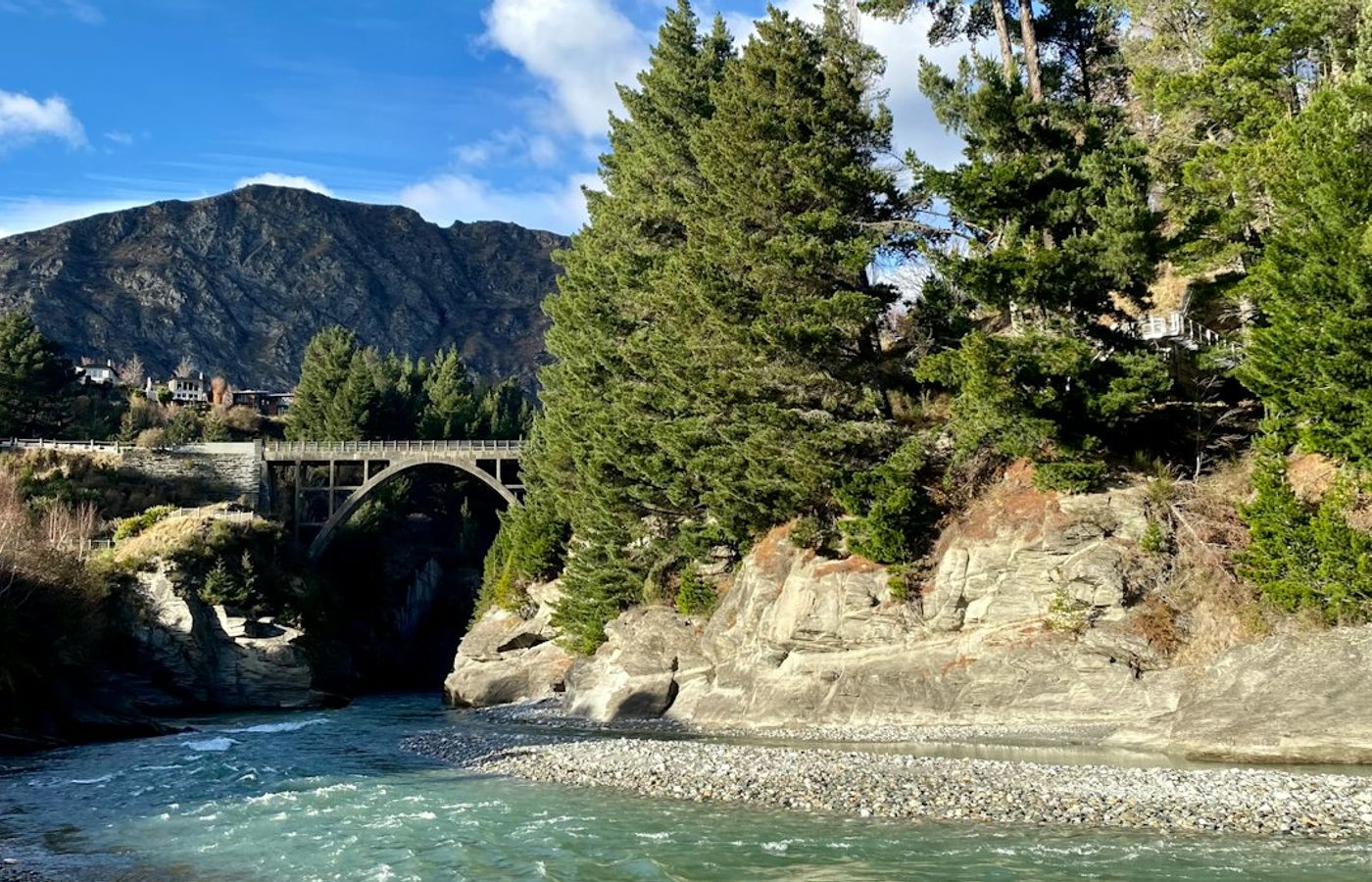

The Frankton Track is the flattest 12 km in this guide and the one to walk on your first day, before you commit to a climb. Part of the wider Queenstown Trail network, it follows the Lake Wakatipu shoreline from the bridge at the Queenstown Gardens entrance around the Frankton Arm to Frankton Marina and back: 12 km return, Grade 2 on the trail network's own scale, with a short steep rise at Battery Hill and around 60 m of cumulative elevation gain overall. Cyclists cover it in an hour or two. Walking it out and back takes a steady 3 to 3.5 hours, and it is easy the whole way.
Everything about the Frankton Track is forgiving for a solo walker. It is never out of sight of houses, boats or State Highway 6, mobile coverage runs unbroken from end to end, and there are toilets and cafes at both the Queenstown Gardens and Frankton ends. Best of all it is a linear route with a bus at the far end: if you have had enough at Frankton Marina, Orbus Route 1 and Route 3 both serve Frankton and get you back to the Stanley Street hub for NZ$2.50 (about EUR 1.30) with a Bee Card. This is also the walk to load into the New Zealand Mountain Safety Council's free Plan My Walk app first, so your emergency contact gets used to the check-in routine on a low-stakes trip before you send them a hill route.
Pro Tip: Walk out from the Queenstown Gardens first and treat Frankton Marina as the decision point - carry on back on foot if you feel strong, or catch the bus if you do not. Doing it in that direction means your bail-out option arrives at the halfway mark rather than at the start, which is exactly where you want it when nobody else is voting.
4Sunshine Bay Track - The Simplest Bus-and-Walk Combination in Queenstown
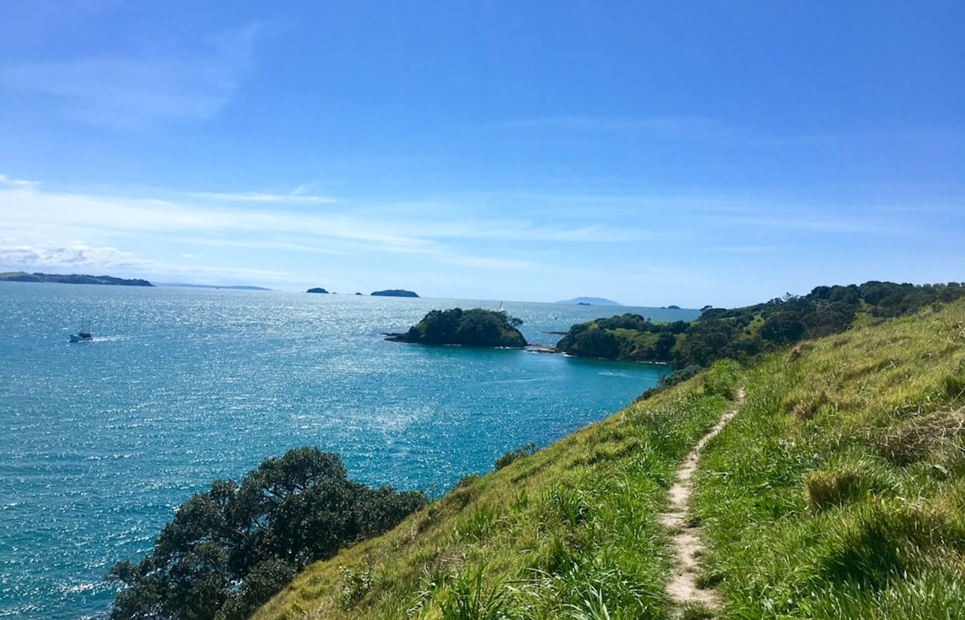
The Sunshine Bay Track is the easiest trail here to reach without a car. Orbus Route 1 terminates at Sunshine Bay, three kilometres west of central Queenstown, which means you are dropped at the trailhead and collected from the same stop. From the reserve car park off Lake Esplanade the track runs 1.6 km along the Lake Wakatipu shoreline through beech and kanuka to a small pebble beach, so 3.2 km return in 1 to 1.5 hours. It is graded easy, with barely 50 m of undulation and no real climbing at all.
The track never leaves the shoreline, which takes route-finding out of the equation entirely: the lake is on your left going out and your right coming back, and there are no junctions to get wrong. Foot traffic is steady and local - dog walkers and Fernhill residents rather than tour groups - and you are never more than about 40 minutes from houses. Its real value is as a short-daylight option. Around the June solstice Queenstown gets roughly 8 hours 45 minutes of light, and this is a walk you can still fit into an overcast winter afternoon without cutting anything fine. There are no toilets or drinking water on the track itself, so use the facilities in town before you get on the bus.
Pro Tip: Check the Route 1 return timetable before you walk out, not after. Services thin out in the evening, and Lake Esplanade back into Queenstown is narrow in places, which is not the road you want to be walking alone at dusk with cars coming round the lake.
5Lake Hayes Loop Track - A Flat 8 km Circuit With Five Ways to Cut It Short
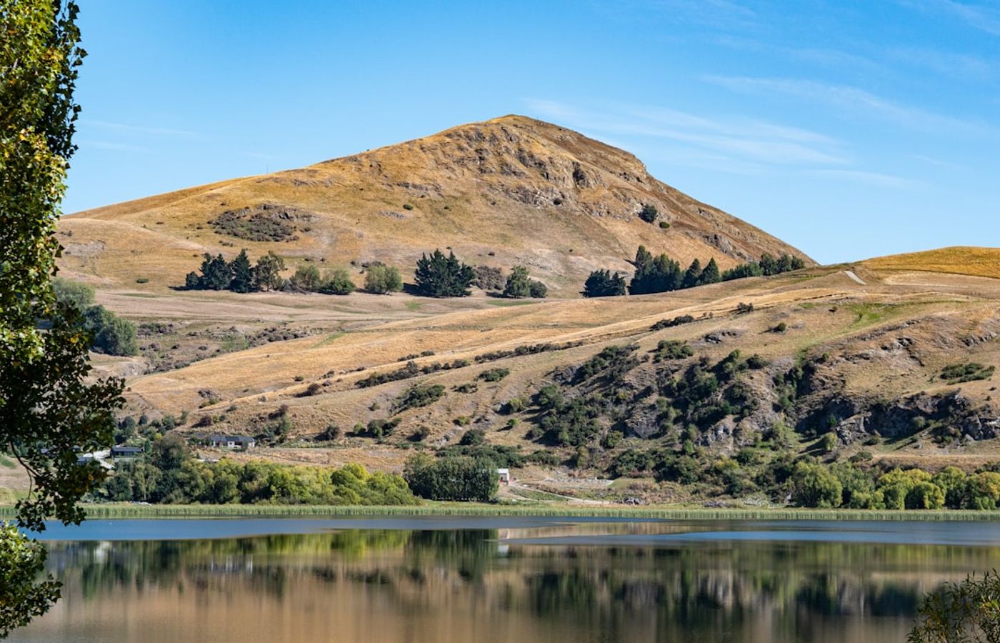
The Lake Hayes Loop Track is the only closed circuit in this guide, and for a solo walker that geometry matters: you finish where you started without having to plan a return leg. The full loop is 8 km with 68 m of total elevation gain, walkable in 2 to 3 hours, graded easy on mostly flat gravel with a few narrow boardwalk sections. Lake Hayes sits about 17 km northeast of Queenstown on State Highway 6, roughly 20 minutes by car, and the Department of Conservation lists five separate access points: the North Lake Hayes picnic area with parking and toilets, the Lake Hayes Pavilion showgrounds on State Highway 6, Bendemeer Bay, Arrowtown Road, and Rutherford Road off Speargrass Flat Road.
Those five entry points are the solo-friendly feature. Each is somewhere to cut the walk short, and Lake Hayes itself stays in view for the whole circuit, so you can always see how much is left. The track is shared all day with runners and cyclists heading through to Arrowtown, so you will not be the only person out there. Two honest caveats: mobile coverage on the far western shore is patchier than anywhere else in this guide, and the boardwalks turn genuinely slippery after rain. Leave your intentions with someone before you go. The New Zealand Mountain Safety Council's advice is to do it in writing - route, start time, expected finish and what gear you are carrying - rather than mentioning it on a phone call that gets half remembered.
Pro Tip: Take Orbus Route 2 out from Frankton Hub and start at the North Lake Hayes picnic area rather than the pavilion. The mirror reflections at the northern end of Lake Hayes are best in the first hour after sunrise, before the wind gets up, and starting there puts the more exposed eastern shore behind you early.
Get hotel deals for Queenstown
Price drops, new stays and local tips for Queenstown, straight to your inbox.
No spam, unsubscribe anytime.

CEO and co-founder
Tomas is the co-founder and director of trip1, an European company specializing in reservation services. He launched the company in 2025 with a focus on building scalable, efficient operations.
5 Best Solo-Friendly Hikes Near Queenstown - FAQ
For walking alone, the Queenstown Hill Time Walk. It starts on foot from town, climbs roughly 500 m to the summit of Te Tapu-nui in two to three hours return, and keeps mobile coverage nearly the whole way. Walkers pass every few minutes from mid-morning, and the Basket of Dreams sculpture, about 20 minutes below the top, makes a natural turnaround.
It is moderate. Queenstown Lakes District Council grades it intermediate: a steady climb of roughly 500 m through pine and beech with almost no flat sections, taking two to three hours return. It is a single track with no junctions, and town stays in view below. The Belfast Terrace car park fills by 9am in summer, so walk up from the waterfront.
Yes, on busy, signposted tracks with some preparation. Leave your route and return time in writing, or use the free Plan My Walk app from the New Zealand Mountain Safety Council. Carry a headtorch, water and a warm layer. The flat Frankton Track is a good first walk: if you tire at Frankton Marina, an Orbus bus back costs NZ$2.50 with a Bee Card.
December to February gives the most margin, with about 15 and a half hours of daylight around the December solstice. In June that falls to roughly 8 hours 45 minutes, sunset is near 5:10pm and the shaded parts of the town hills hold ice. Note that Roys Peak, near Wanaka, closes every year from 1 October to 10 November for lambing.
About an hour up and 40 minutes down. The trail climbs 2.1 km and 480 m from beside the Skyline gondola base on Brecon Street to Bob's Peak, with steep, rooty sections near the top. At the summit there are toilets, water and a cafe, and one-way gondola tickets, so you can ride down. In June and July, start by 3pm.
The full loop is 8 km with 68 m of climbing, about 2 to 3 hours on mostly flat gravel and boardwalk. It is about 20 minutes from Queenstown, and Orbus Route 2 runs past it from Frankton Hub. Five access points let you cut it short. Mobile coverage is patchy on the western shore, and the boardwalks are slippery after rain.