
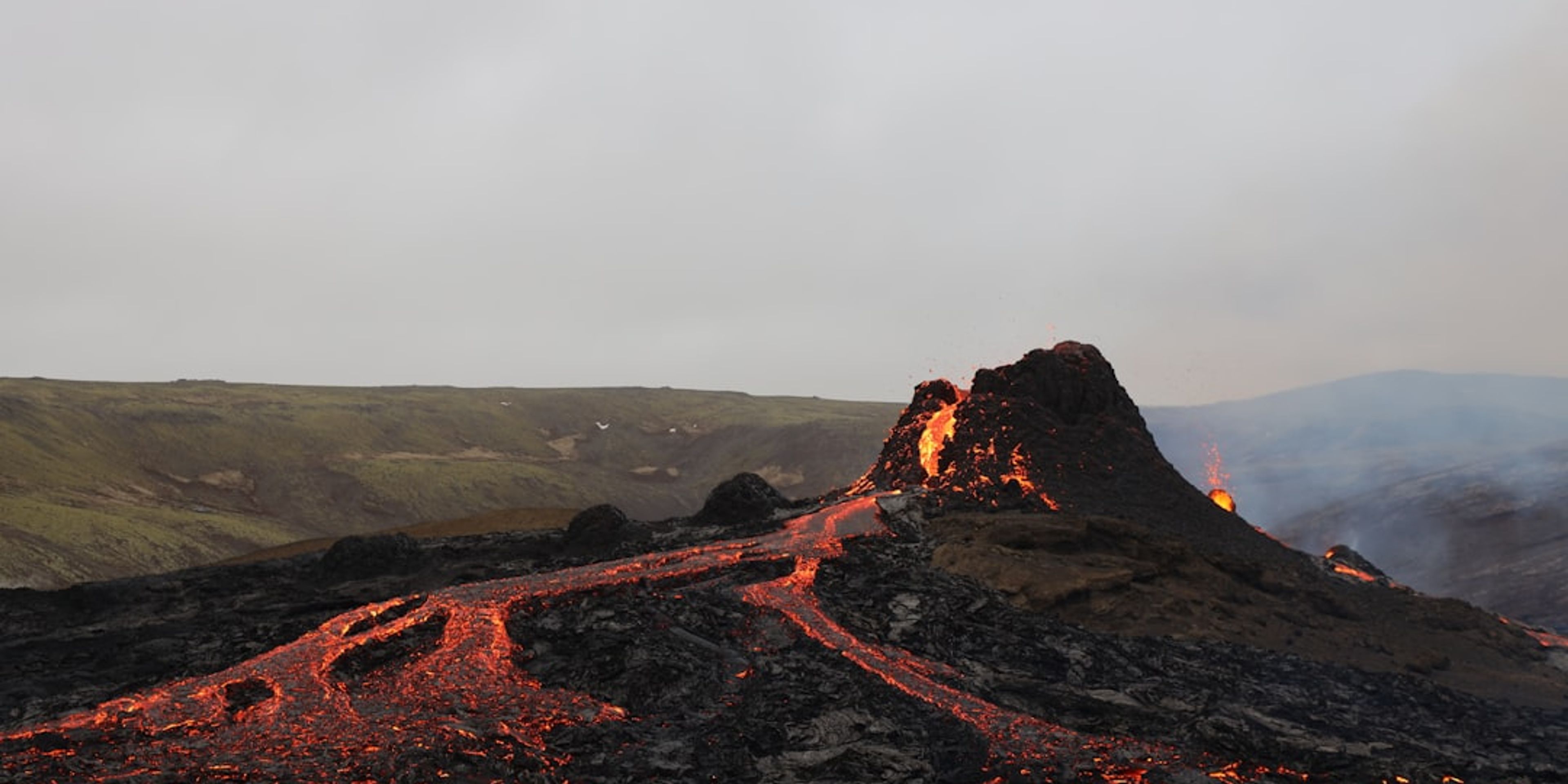

Guides · Taupō
5 Best Volcanic Hikes Near Taupō

CEO and co-founder
The best volcanic hikes near Taupō start where the tarmac ends on State Highway 47, about 90 minutes south of the lake. Taupō itself fills a caldera left by the Ōruanui and Hatepe eruptions, and the three andesite cones of Tongariro National Park - Mount Tongariro, Mount Ngauruhoe and Mount Ruapehu - are all still active. This guide picks 5 walks and orders them hardest to easiest, so you can match the day to your fitness, your transport and the forecast rather than to a bucket list.
Every entry below gives the trail distance in kilometres, the elevation gain in metres, a realistic round-trip or one-way time, the difficulty grade, the exact trailhead car park or visitor centre address, and a Pro Tip. Four of the five are Tongariro National Park walks and cluster around two road ends: the Mangatepopo Road car park off State Highway 47, and Whakapapa Village off State Highway 48. The fifth, the Craters of the Moon geothermal walkway, sits 6 km north of the Taupō i-SITE and is the one to hold in reserve for the day the alpine forecast collapses. Between them these Taupō hiking trails span a 19.4 km alpine crossing and a 40-minute boardwalk loop.
Two constraints shape any plan here. The Tongariro Alpine Crossing now requires a free Department of Conservation booking, and a four-hour parking limit at both road ends from mid-October to April means almost everyone uses a shuttle. Second, Ngā Iwi o Te Kāhui Maunga, the iwi whose ancestors these mountains are, ask visitors not to stand on the summits or touch the crater lakes, because both are tapu (sacred). The routes below are written to respect that request, which is why the volcano hikes New Zealand is famous for appear here as crater and ridge walks rather than summit bids. Cloud on the saddle is what turns a booked crossing into a wasted shuttle fare, so check Taupō weather the evening before and again at the road end rather than trusting a forecast issued three days out. Shuttles leave town between 5:30 and 7:00 a.m. and will not wait, which rules out any base more than twenty minutes from the lake, and the hotels in Taupō along Lake Terrace keep you inside that window without a pre-dawn drive.
1Tongariro Alpine Crossing - New Zealand's Benchmark Volcanic Day Hike
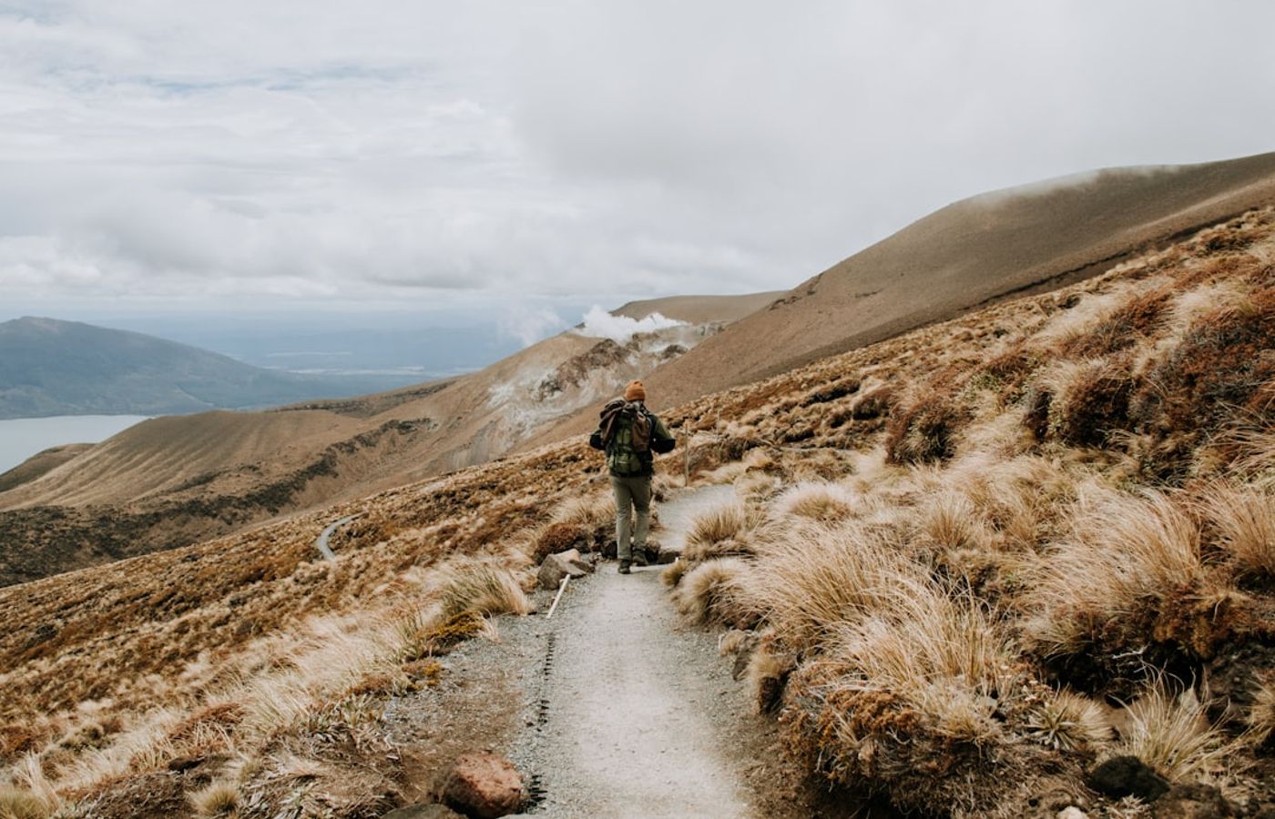

The Tongariro Alpine Crossing runs 19.4 km one way, climbs and drops a cumulative 1,196 m, and tops out at Red Crater at 1,886 m. You start at the Mangatepopo Road car park at 1,120 m and finish on Ketetahi Road at 760 m, which is why it cannot be walked as a loop and why transport, not fitness, is the first thing to sort out. The Department of Conservation grades it intermediate to expert and allows 7 to 8 hours from November to April, stretching to 9 hours from May to October. This is not a casual walk. The climb out of Mangatepopo includes the Devil's Staircase, the descent off Red Crater is ankle-deep loose scoria, and the final 8 km down to Ketetahi is a knee-punishing grind through tussock and beech forest that catches most people out.
A free DOC booking is now required for anyone using any part of the track, and a four-hour parking limit applies at both road ends from mid-October through April, so most walkers take a shuttle from Taupō, Tūrangi or National Park Village for around NZ$78 (roughly EUR 40) in 2026 - a figure that includes the NZ$10 plus GST community contribution DOC charges per person transported. Weather is the real hazard rather than the distance: the exposed stretch between South Crater and Blue Lake has no shelter at all and can swing from 20°C sunshine to horizontal sleet inside an hour. From June to October the route is genuine alpine terrain with snow, ice and avalanche risk, and you need a guide, an ice axe and crampons. Track conditions and the daily forecast are posted on the official DOC Tongariro Alpine Crossing page. The Emerald Lakes and Blue Lake are tapu: look and photograph, but do not touch the water.
Pro Tip: Book the earliest shuttle you are offered, usually a 5:30 am or 6:00 am departure from Taupō in summer. Getting up the Devil's Staircase before 8:30 am puts you over Red Crater ahead of the crowd and, more usefully, ahead of the afternoon westerly that funnels through South Crater almost every day.
2Mount Tongariro and Red Crater - The Volcanic Core Walked as a Return Trip
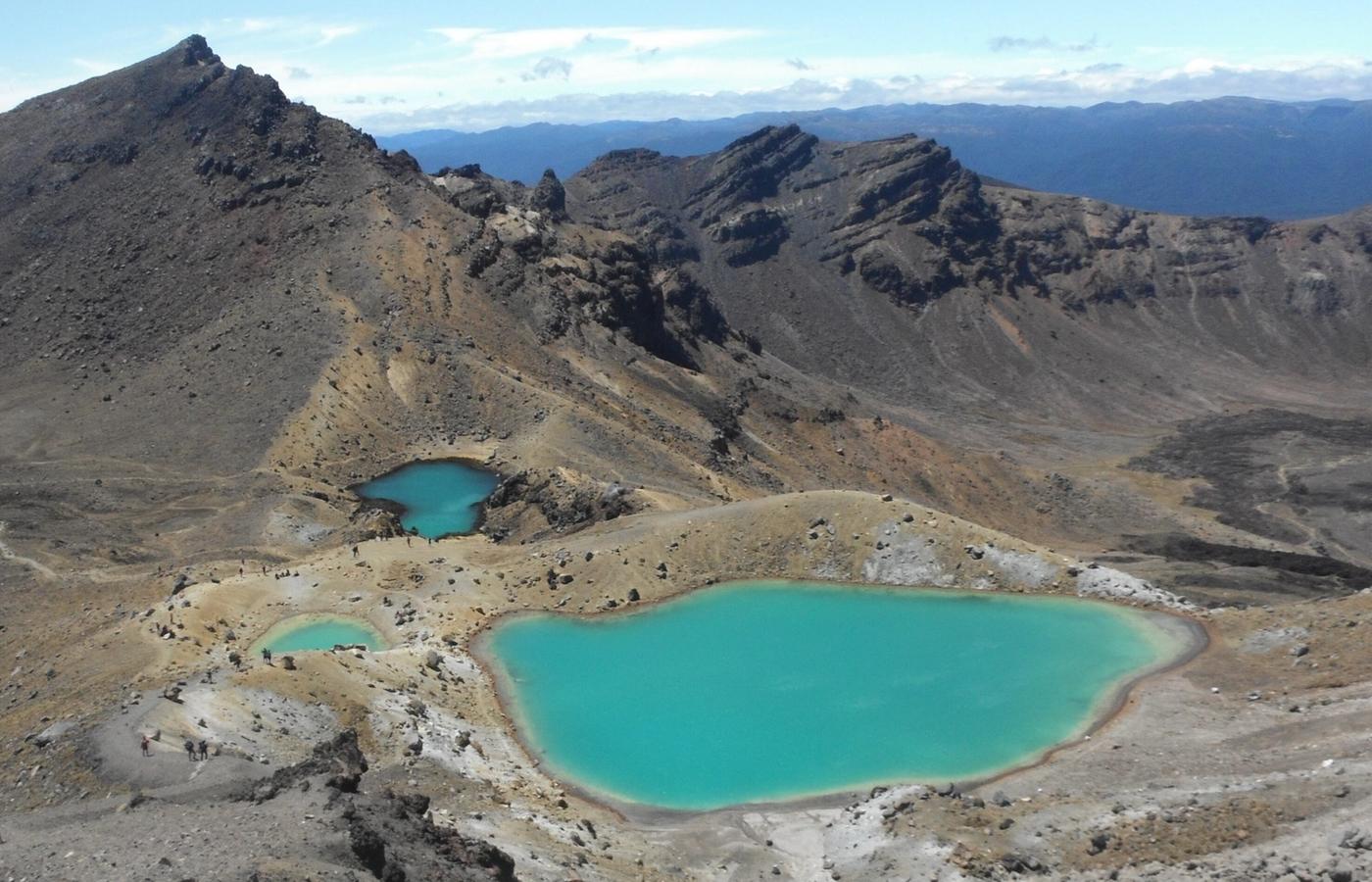

Walking in from the Mangatepopo Road car park to Red Crater and back out again is about 15 km return with roughly 770 m of climbing, and takes 6 to 7 hours at a steady pace. It is an advanced route on the same tread as the full Crossing, but it hands back the two things that make the one-way trip stressful: you finish where you started, and you can turn around at South Crater without wrecking anyone's shuttle logistics. Mount Tongariro is not a single cone but a complex of at least 12 vents, and this is the section where that becomes obvious - the flat black gravel plain of South Crater, the oxidised red and ochre walls of Red Crater at 1,886 m, and away to the north the Te Māri craters, which erupted in August and November 2012, their first activity since 1897.
Be clear about Mount Ngauruhoe before you go. The 2,287 m cone rises straight off South Crater and an informal turn-off is still visible on the ground, but the honest 2026 position is this: Ngauruhoe sits on public conservation land inside Tongariro National Park, not on private Māori land, and no law bans the climb - yet DOC removed every piece of summit signage in 2017 and, alongside Ngāti Hikairo ki Tongariro and Ngāti Tūwharetoa, asks people not to go up because the summit is tapu. Iwi rangers work the turn-off through the November to April peak and will ask you to reconsider, and several shuttle concessionaires decline to carry walkers who state a summit intention. The climb is also 600 m of shifting scoria with a real rockfall risk onto the people below you. Skip it. One practical catch on this route: the four-hour parking limit at Mangatepopo from mid-October to April makes a true self-driven return walk awkward, so in high season you may still need a shuttle drop-off and pick-up.
Pro Tip: Do this version in late April or early May, after the parking limit lifts but before the winter alpine season begins. You get the Red Crater ridge almost to yourself, the shuttle fleet has thinned out, and you can leave your own car at Mangatepopo for the whole day.

3Tama Lakes Track - Explosion Craters Between Ngauruhoe and Ruapehu
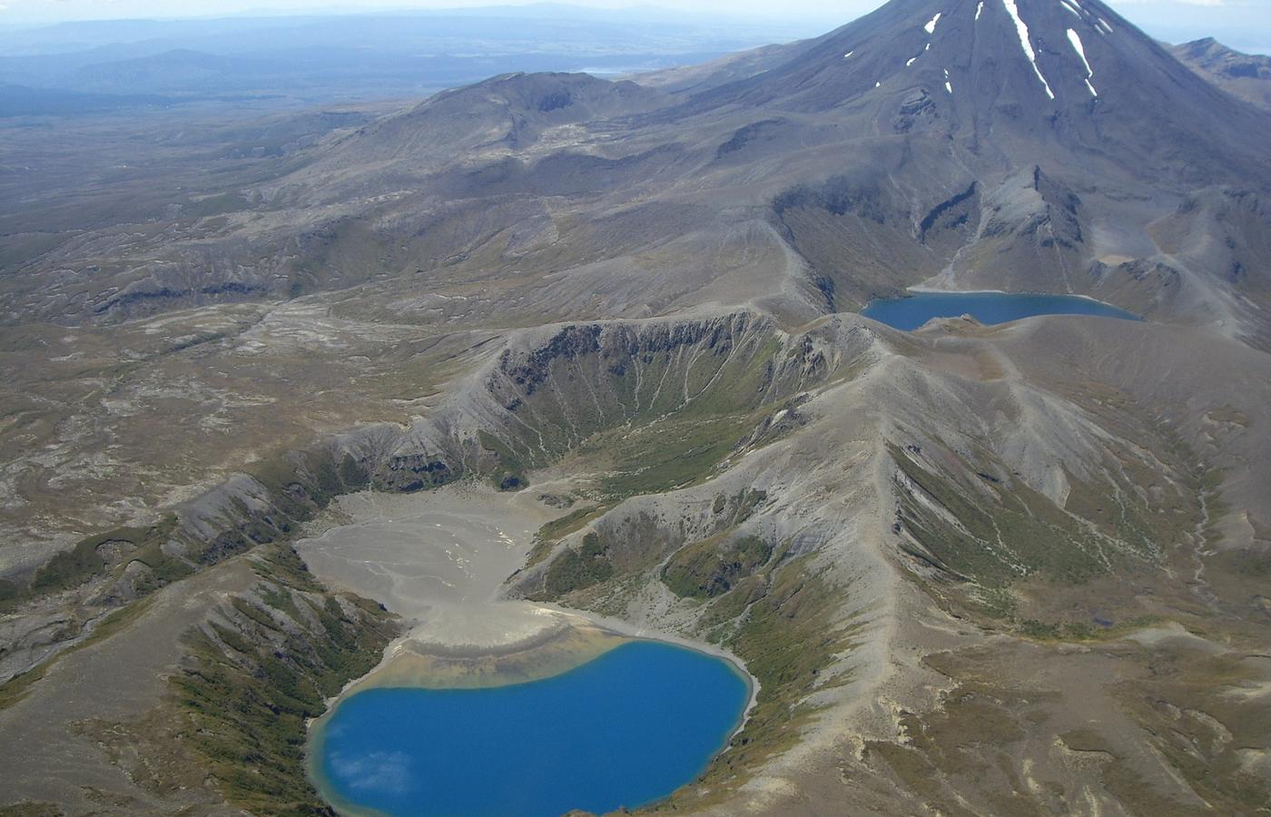

The Tama Lakes Track is 17 km return from Whakapapa Village, takes 5 to 6 hours, and climbs about 340 m to the Tama Saddle, or closer to 500 m if you add the Upper Tama Lake lookout. DOC grades the main track intermediate. The payoff is geological rather than scenic in the ordinary sense: the Tama Lakes fill explosion craters blasted out roughly 10,000 years ago during a violent eruptive period, and they sit in the saddle between Mount Ngauruhoe to the north and Mount Ruapehu to the south, so on a clear day both cones frame the same view. Lower Tama Lake is seen from the saddle itself. The Upper Tama Lake lookout is a different proposition - 1.4 km and about 35 minutes one way on an unformed advanced tramping route over loose, slippery rock that is considerably harder than anything on the main track.
No formed track descends to either lake, and DOC asks visitors not to enter or touch the water, partly to keep these alpine lakes weed-free and partly because they are tapu. The Tama Saddle funnels the prevailing westerlies, so a windproof shell is not optional even on a warm February afternoon. Practically, this is the easiest of the serious volcanic walks to organise: no booking, no fee, no shuttle, and free parking at Whakapapa Village. The first 15 minutes share tread with the Taranaki Falls Walking Track, a 6 km, 2-hour easy loop to a 20 m waterfall that drops over an andesite lava flow erupted from Mount Ruapehu around 15,000 years ago - a sound bail-out if the saddle is socked in by the time you reach the junction.
Pro Tip: Start at the trailhead 100 m below the Tongariro National Park Visitor Centre on Ngauruhoe Place and take the Taranaki Falls section on the way out rather than the way back. You reach the falls inside 40 minutes, so the day still delivers something worth driving for even if you bail at the Tama Saddle.
4Mount Ruapehu Crater Lake - The Guided Route to an Active Volcano's Lake
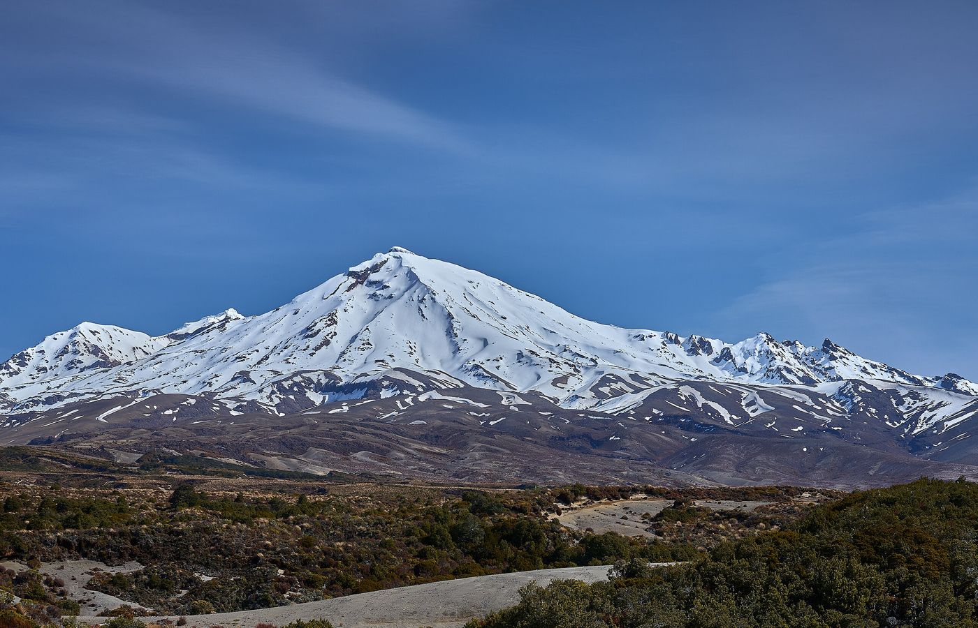
Mount Ruapehu is the North Island's highest mountain at 2,797 m and the most consistently restless of the three volcanoes, and its summit plateau holds Te Wai ā-moe, the Crater Lake. The standard route is about 10 km return from Iwikau Village at the top of Bruce Road, roughly 7 hours, with something like 1,050 m of climbing to the Crater Lake lookout near Dome Shelter at about 2,672 m. Riding the Sky Waka gondola up to Knoll Ridge Chalet at 2,020 m cuts that to around 5 hours and 650 m of gain. Grade: expert, and that grade is not negotiable. There is no marked track. DOC states plainly that anyone attempting Ruapehu even in summer needs mountaineering, alpine, backcountry and navigation skills, that every route to the summit crosses avalanche terrain, and that Dome Ridge is narrow, steep and frequently icy.
This is the one walk in this guide you should not attempt independently unless you already hold those skills, and it is also the one where the cultural position weighs heaviest. DOC actively discourages hiking into Ruapehu's summit hazard zones, and Ngā Iwi o Te Kāhui Maunga ask visitors not to summit the mountains of Tongariro National Park at all; the Crater Lake is tapu. Guided summit-plateau trips run out of Whakapapa and Ohakune through the summer and supply the ice axe, crampons and helmet. Volcanic risk is live rather than theoretical - Mount Ruapehu erupted in 1995 and 1996 and again in 2007, and lahars can run down the valleys with little warning. The Sky Waka gondola operates 10 am to 4 pm from 1 November to 30 April 2026 at NZ$39 for adults (about EUR 20) and NZ$19 for youth, which also makes it the painless way to stand at 2,020 m if you decide the full climb is not for you.
Pro Tip: Check the GeoNet volcanic alert level for Mount Ruapehu the night before, not on the morning. Level 1 unrest is normal and changes nothing, but a shift to Level 2 usually closes the summit plateau to guided parties, and knowing early lets you swap the day for the Tama Lakes Track instead of wasting the drive.
5Craters of the Moon Geothermal Walk - Taupō's Steaming Ground, Ten Minutes From Town
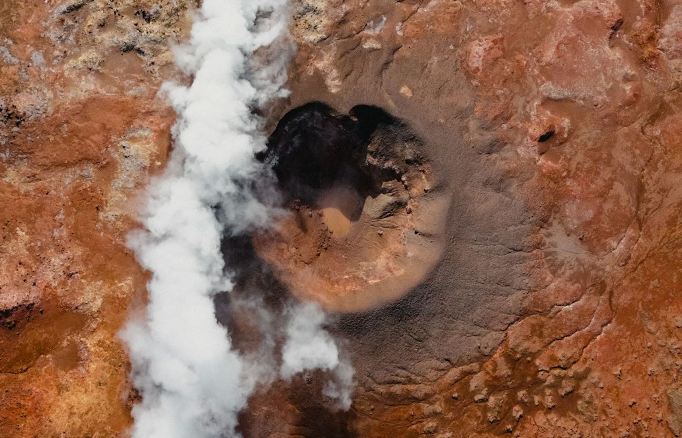
Craters of the Moon is the volcanic walk you can do in trainers before breakfast. The full circuit is about 2.7 km of boardwalk and fine gravel with roughly 60 m of gentle climbing: the main loop takes 40 minutes and the upper walkway to the lookout adds another 20 minutes over a flight of steps. Difficulty: easy, and the main loop is manageable with a pushchair. What you walk through is a live geothermal field inside the Taupō Volcanic Zone, part of the wider Wairākei system - steam vents, boiling mud pools, collapsed craters and bare, sulphur-stained ground too hot for anything to root in. The largest crater is roughly 40 m across. The field only became this active after the Wairākei power station began drawing on the underground reservoir in the late 1950s, dropping pressure and pushing steam to the surface.
The entrance is at 140 Karapiti Road, Wairakei, about 6 km north of central Taupō and a 10-minute drive from the lakefront, which makes it the obvious substitute when the Tongariro forecast falls apart. Entry in 2026 is NZ$10.20 for adults (about EUR 5.30), NZ$5.10 for children aged 5 to 15 and for seniors, NZ$25.50 for a family of two adults and up to four children (about EUR 13), and free for under-5s; Taupō residents get 50% off with proof of address. The site opens 9:30 am to 5 pm, 364 days a year, with last entry at 4 pm and only Christmas Day closed. Stay on the boardwalk without exception - the crust is thin, the ground beneath it sits near boiling point, and the surface genuinely changes from year to year as new vents break through.
Pro Tip: Arrive within an hour of the 9:30 am opening on a cold morning. Below about 8°C the steam plumes are dense enough to hide the far side of the main crater, which is the shot everyone comes for, and the low sun picks out the yellow sulphur crusts that wash flat by midday.
Get hotel deals for Taupō
Price drops, new stays and local tips for Taupō, straight to your inbox.
No spam, unsubscribe anytime.

CEO and co-founder
Tomas is the co-founder and director of trip1, an European company specializing in reservation services. He launched the company in 2025 with a focus on building scalable, efficient operations.
5 Best Volcanic Hikes Near Taupō - FAQ
Hard for a day walk. It runs 19.4 km one way with 1,196 m of cumulative climbing and descent, topping out at Red Crater at 1,886 m, and the Department of Conservation grades it intermediate to expert. Expect the Devil's Staircase on the way up, loose scoria off Red Crater and a long 8 km descent to Ketetahi that is hard on the knees.
Fit enough to walk for 7 to 8 hours over steep, uneven ground. The Department of Conservation says the fitness needed is high and does not recommend the Crossing for children under 10. If you hike regularly, you will manage at a steady pace, but the weather is the bigger risk: the stretch between South Crater and Blue Lake has no shelter at all.
The walk itself is free, and so is the DOC booking. You pay for transport, because the track is one way and in summer there is no parking for Crossing walkers at Mangatepopo. A shuttle from Taupō costs around NZ$78 (about 40 euros) in 2026, pickups closer to the park can be cheaper, and part of the fare goes to DOC conservation work.
November to April, and ideally December to March, when DOC allows 7 to 8 hours. From May to October the route is alpine terrain with snow, ice and avalanche risk, and you need a guide, an ice axe and crampons. In any month, check the forecast the evening before and again at the road end, because cloud on the saddle can wipe out the views.
Yes, if you use a shuttle or guided walk, which almost everyone does. The DOC booking is free and recommended for everyone using any part of the track. In summer there is no parking for Crossing walkers at Mangatepopo, so the usual plan is a shuttle, or the private car park at Ketetahi with a shuttle to the start. Take the earliest departure you can.
Only with a guide, unless you already have mountaineering skills. There is no marked track: the route is about 10 km return from Iwikau Village, around 7 hours across avalanche terrain, and the Sky Waka gondola cuts it to about 5 hours. The Crater Lake is tapu and local iwi ask visitors not to summit. Check the GeoNet volcanic alert level the night before.